
 Service

MXD (Map Exchange Document)
MXD (Map Exchange Document) is a map document file format in Esri ArcGIS software. MXD files contain map layers, symbols, annotations, legends, and other information, as well as map view settings and map layouts. It is a binary file format used to store and share geospatial data and map designs.
2025-09-16 14:47:37
HDF (Hierarchical Data Format)
HDF (Hierarchical Data Format) is a file format used to store and manage large scientific data sets. It is a container for multidimensional arrays and complex data structures, and is widely used in science, engineering, and research. It can store many types of data, including numerical values, images, audio, text, etc. It supports hierarchical structures, allowing data sets to be stored and accessed in a multi-level organizational manner, facilitating data organization, retrieval, and analysis.
2025-09-16 14:47:37
SL3 (Spatialite Version 3 Database File)
SL3 (Spatialite Version 3 Database File) file format is a SQLite database file with the extension .SL3, which contains spatial data tables and related spatial indexes. It uses the file structure and data organization of the SQLite database, and adds the functions of spatial data storage and query on this basis.
2025-09-16 14:47:36
NC (NetCDF, Network Common Data Form)
NC (NetCDF, Network Common Data Form) is a self-describing, cross-platform scientific data format, widely used in meteorology, oceanography, earth science and other fields, for storing multidimensional array data (such as temperature, rainfall, wind speed, etc.). NetCDF is developed and maintained by Unidata and is one of the important standards in the field of scientific computing and analysis. It uses a hierarchical data model to store data in the form of variables, dimensions and attributes, making it flexible to represent complex scientific data sets while being efficient and easy to use.
2025-09-16 14:47:36
VMDS (Visual Model Data Stream)
VMDS (Visual Model Data Stream) is an efficient file format for 3D model data, designed for real-time rendering and fast loading of complex scenes. VMDS files are usually used to store and transmit 3D models, materials, animations, and related metadata. With streaming and compression as its core features, it supports efficient processing of large-scale 3D scenes, and is therefore widely used in game development, virtual reality (VR), augmented reality (AR), and geographic information systems (GIS).
2025-09-16 14:47:36
GPKG(GeoPackage)
GeoPackage (GPKG) is an open standard geospatial data storage format launched by OGC (Open Geospatial Consortium). It is based on SQLite database files and can efficiently store and manage vector data, raster data, and other spatial related information. GPKG files are designed to solve the problems of fragmentation and poor compatibility of traditional GIS file formats, and support offline data storage and cross-platform data sharing through a unified format. Compared with traditional GIS files (such as Shapefile or GeoTIFF), GPKG files have greater flexibility and scalability and are considered to be an ideal choice for modern geographic information applications.
2025-09-16 14:47:35
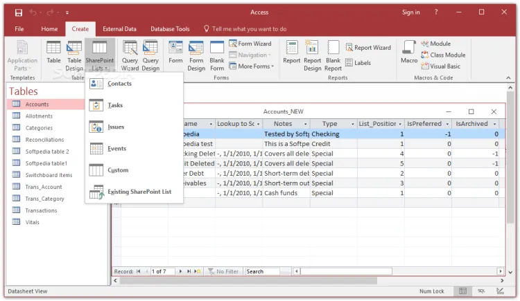
MDB(Microsoft Access Database)
In GIS, MDB refers to the extension of Microsoft Access Database files, which are used to store geospatial data and attribute data. MDB files are a common GIS data format that can contain geographic information such as vector data, raster data, attribute tables, and relationships. By using MDB files, GIS software can read and process geospatial data to perform operations such as map making, spatial analysis, and data query.
2025-09-16 14:47:34
GDB(File Geodatabase)
GDB file refers to the storage format of File Geodatabase, which is developed by Esri and used in its ArcGIS platform. It is one of the common spatial data management formats in the current Geographic Information System (GIS). File Geodatabase provides an efficient way to store, manage and query various spatial data. Unlike traditional single file storage, GDB file is a folder structure containing multiple files, which can store vector data, raster data and non-spatial table data.
2025-09-16 14:47:34
SID(MrSID, Multi-Resolution Seamless Image Database)
SID (MrSID, Multi-Resolution Seamless Image Database) is a raster data format specially designed for the storage and distribution of geospatial images, developed by LizardTech in the United States. It is well-known for its efficient image compression technology and is widely used in industries that need to store and transmit large-scale image data, such as geographic information systems (GIS), remote sensing, and mapping.
2025-09-16 14:47:33