
 Service


AGD84 (Australian Geodetic Datum 1984) – EPSG:4203
AGD84 (Australian Geodetic Datum 1984) – EPSG:4203 is a regional geodetic datum that served as an interim update to AGD66, released by the Australian National Mapping Council in 1984. While still based on the Australian National Spheroid (ANS) and non-geocentric origin, AGD84 incorporated additional survey data and improved adjustment techniques, resulting in better positional accuracy than its predecessor. Unlike AGD66, which was a purely national adjustment, AGD84 included improved ties to international datums and incorporated Doppler satellite observations to better constrain the network. However, AGD84 was short-lived, as the shift toward geocentric datums (GDA94) began in the 1990s. Today, AGD84 is rarely used but remains relevant for certain legacy datasets produced during the late 1980s and early 1990s.
2026-05-14 19:27:30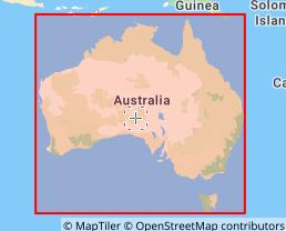
AGD66 (Australian Geodetic Datum 1966) – EPSG:4202
AGD66 (Australian Geodetic Datum 1966) – EPSG:4202 is a regional geodetic datum that served as the official coordinate reference system for Australia from the late 1960s until its gradual replacement by GDA94 (Geocentric Datum of Australia 1994) in the 1990s. Developed by the Australian National Mapping Council, AGD66 was based on a network of approximately 1,200 survey stations adjusted using classical terrestrial measurements (triangulation and trilateration) and the Australian National Spheroid (ANS), a modified version of the GRS 1967 ellipsoid. Unlike modern geocentric datums, AGD66 is a local, Earth-fixed datum with its origin offset from the Earth's center by approximately 200 meters. While largely obsolete today, AGD66 remains important for interpreting legacy maps, historical GIS data, and older resource exploration records across Australia.
2026-05-14 19:22:36
NAD83(2011) – EPSG:6318
NAD83(2011) – EPSG:6318 is the most recent realization of the North American Datum of 1983 (NAD83), released by the U.S. National Geodetic Survey (NGS) in 2011 as part of the National Spatial Reference System (NSRS). It succeeded NAD83(NSRS2007) and represents the culmination of over a decade of GPS observations from approximately 2,000 Continuously Operating Reference Stations (CORS) and thousands of passive control marks. NAD83(2011) achieved improved alignment with the International Terrestrial Reference Frame (ITRF2008) while maintaining the plate-fixed nature of NAD83. It is currently the official NSRS realization recommended by the NGS for high-precision surveying, mapping, and GIS applications across the United States.
2026-05-14 19:18:49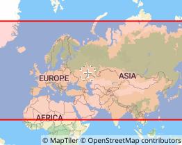
NAD83(NSRS2007) – EPSG:4759
NAD83(NSRS2007) – EPSG:4759 is a realization of the North American Datum of 1983 (NAD83), released by the U.S. National Geodetic Survey (NGS) in 2007 as part of the National Spatial Reference System (NSRS). It succeeded NAD83(HARN) and preceded NAD83(2011). NSRS2007 was a nationwide re-adjustment that incorporated GPS observations from approximately 1,800 Continuously Operating Reference Stations (CORS) and thousands of survey markers, achieving consistent accuracy of approximately 0.01–0.05 meters across the entire United States. Unlike earlier realizations, NSRS2007 provided a single, unified, nationwide adjustment rather than state-by-state HARN adjustments.
2026-05-14 19:13:23
NAD83(HARN) – EPSG:4152
NAD83(HARN) – EPSG:4152 is a high-precision realization of the North American Datum of 1983 (NAD83), developed through the High Accuracy Reference Network (HARN) program by the U.S. National Geodetic Survey in the 1990s. By incorporating GPS observations, it improved positional accuracy to approximately 0.01–0.05 meters, significantly better than the original NAD83. While superseded by newer realizations, it remains widely used in legacy GIS data and local government applications across the United States.
2026-05-14 19:06:54
TopoJSON (Topology JSON Format)
TopoJSON (Topology JSON Format) is a JSON-based vector data format designed to efficiently represent geospatial data. Proposed by American data visualization researcher Mike Bostock, it extends the standard GeoJSON format and is characterized by explicitly preserving the topology (adjacency relationships and shared boundaries) of geographic data. TopoJSON adopts a structure where boundary lines shared among multiple geographic objects are stored only once and then referenced, enabling significant data size reduction. Therefore, it is widely used in scenarios requiring lightweight, high-speed geographic data delivery, such as web maps and data visualization.
2026-04-28 14:14:36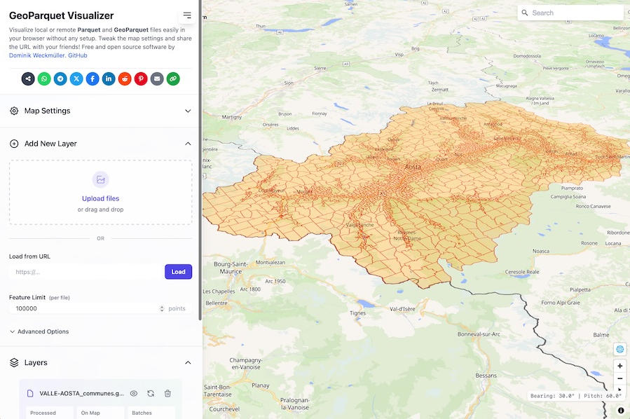
Parquet / GeoParquet
Parquet / GeoParquet is a cloud-native data format built on Apache Parquet, a columnar data format, extended to efficiently store and process geospatial data. GeoParquet adds metadata specifications for handling geospatial information and is designed to enable high-speed processing of large-scale spatial data in cloud environments and distributed processing platforms. It is primarily used in environments such as big data analytics, cloud GIS, and geospatial data lakes, and is recognized as a next-generation geospatial data format gaining attention within the Open Geospatial Consortium (OGC) community.
2026-04-28 14:00:33
Feather / GeoArrow
Feather / GeoArrow is a geospatial data format extended from Apache Arrow, a columnar data format designed for high-speed data processing. It is designed to efficiently store and transfer large volumes of vector geographic data, achieving faster read/write performance and memory efficiency than conventional GIS formats. It is gaining attention as a next-generation format for high-speed processing of geographic data, particularly in cloud environments and big data analytics platforms. GeoArrow utilizes Arrow's columnar memory structure and is characterized by its ability to manage geometry and attribute data in a unified manner.
2026-04-28 13:50:15
ENVI .HDR + .DAT
ENVI .HDR + .DAT is a raster data format widely used in ENVI, a remote sensing analysis software. It is primarily designed for storing multispectral images such as satellite imagery, aerial photographs, and hyperspectral data. This format consists of a combination of a .DAT file that stores the actual pixel data and a .HDR header file that stores metadata such as image size, number of bands, data type, and coordinate system. The ENVI format is simple in structure yet highly flexible, and is widely used in the fields of remote sensing and geospatial analysis. Additionally, due to its near-open specification, it can be read by many GIS and remote sensing software applications.
2026-04-28 13:46:13
Nextzen / Mapzen Turn-by-Turn API
Nextzen / Mapzen Turn-by-Turn API is an open-source navigation service that supports multiple modes of transportation including car, bicycle, walking, and public transit. It is used to integrate route planning, navigation instructions, and travel time estimation into web or mobile applications. It provides dynamic route calculation and real-time navigation capabilities, allowing developers to implement draggable waypoints and obtain text-based navigation instructions in Leaflet maps via plugins such as lrm-mapzen. Since the Mapzen service has been shut down, Nextzen, as its successor, offers a similar API integration solution, including routing and map data services.
2026-04-24 16:34:56