Projected Coordinate System
GISBox is a one-stop 3D GIS data editing, conversion and publishing platform that supports editing in multiple GIS formats such as OSGB/GEOTIFF/RVT, converting to 3DTiles/Terrain and publishing.
Introduction
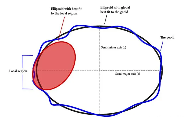
A projected coordinate system is a plane coordinate system whose map units are usually meters or kilometers. It is obtained from the projection of the earth’s approximate ellipsoid and corresponds to a geographic coordinate system. A projected coordinate system uses a coordinate system based on X and Y values to describe the location of a point on the earth.
Parameter
The determination of the projection coordinate system mainly depends on two parameters: geographic coordinate system and projection method.
Geographic coordinate system: determined by the datum, such as Beijing 54, Xi’an 80, WGS84, etc.; and there are many projection methods, such as Gauss-Krüger projection, Lambert projection, Mercator projection, etc.
Projection method: Different projection methods are suitable for different regions and purposes. They will produce different degrees of distortion in shape, area, distance or direction. Therefore, choosing a projection method that can minimize distortion is crucial to meet the specific needs of maps or analysis.
Pros
1. Simplify map making and spatial analysis: The projected coordinate system can convert the three-dimensional spatial information of the earth’s surface into two-dimensional plane information, thereby simplifying the map making and spatial analysis process.
2. Maintain a certain degree of accuracy: Although there will be some deformation during the projection process, the projected coordinate system can usually perform map making and spatial analysis under the premise of ensuring a certain degree of accuracy.
3. Support multiple projection methods: The projected coordinate system supports multiple projection methods, such as Gauss-Krüger projection, Lambert projection, Mercator projection, etc.
**4. Unified standards: **In some fields, such as Web map applications, the projected coordinate system has become a de facto standard.
Cons
**1. Deformation: **Since the projection coordinate system converts the three-dimensional spatial information on the earth’s surface into two-dimensional plane information, it will produce certain deformation.
**2. Restricted by the projection area: **Different projection methods are suitable for different projection areas. For points far away from the projection area, its accuracy may be reduced.
**3. Conversion parameters are required: **When converting between geographic coordinate system and projection coordinate system, conversion parameters need to be provided.
**4. Data processing complexity: **Although the projection coordinate system simplifies the process of map making and spatial analysis, there is still a certain complexity in data processing.
Application Scenario
Projection coordinate systems have extensive application value in map making, spatial analysis, navigation and positioning, meteorological and climate research, and resource exploration and development.
Example
- Projection coordinate systems.
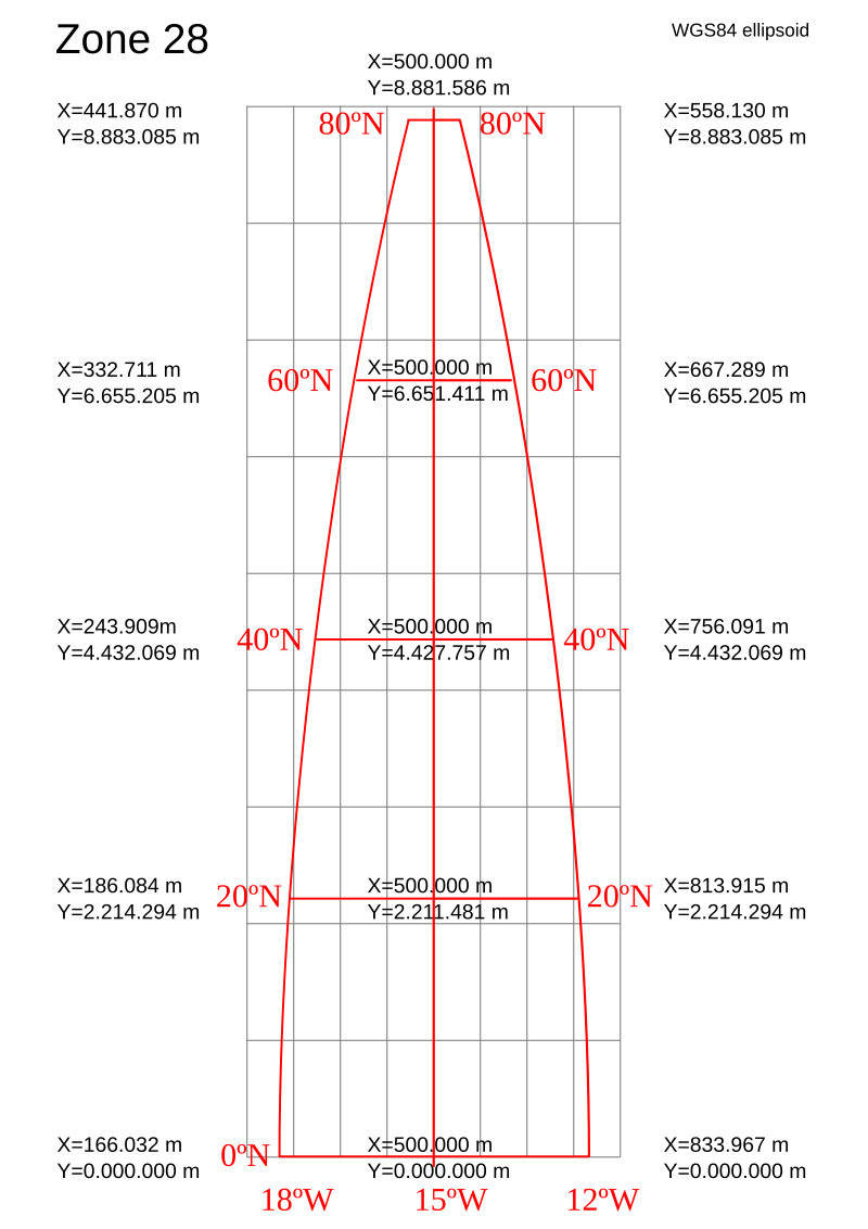
- Layout of a UTM coordinate system.