
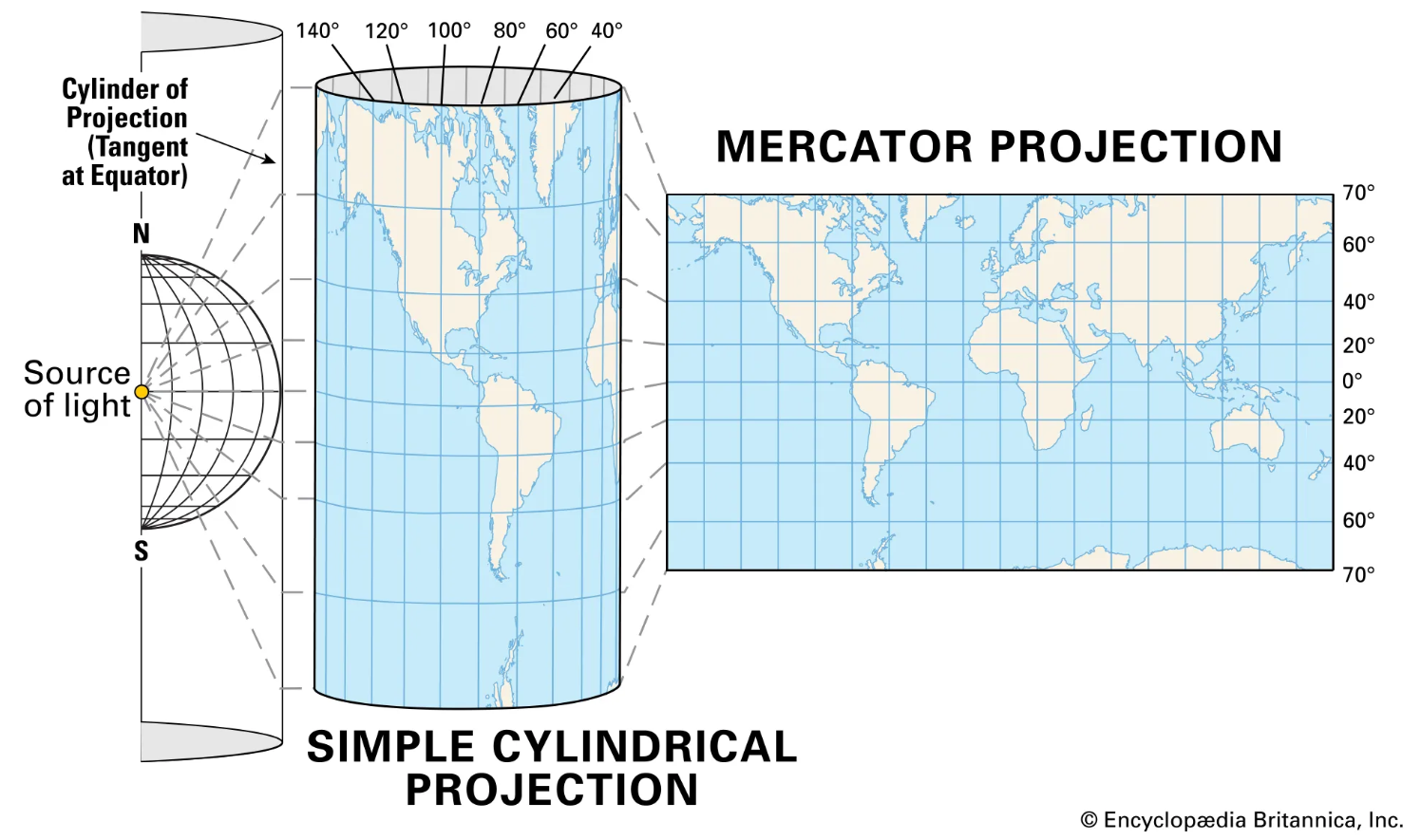
Mercator Projection
GISBox is a one-stop 3D GIS data editing, conversion and publishing platform that supports editing in multiple GIS formats such as OSGB/GEOTIFF/RVT, converting to 3DTiles/Terrain and publishing.
Introduction
Mercator Projection is one of the most famous map projections. It was first proposed by Franz Walter Mercator (Gerardus Mercator) in 1569 and is mainly used for drawing nautical charts. Mercator projection is a kind of orthogonal cylindrical projection, also known as “standard cylindrical projection”. Its characteristic is that it can project the longitude and latitude coordinates of the earth onto a plane, keeping the angle unchanged, so it is very useful in navigation and aviation.
Data Format Overview
In Mercator projection, commonly used data formats include:
**1. GeoJSON: **GeoJSON format is widely used to represent map data and can support geometric figures under Mercator projection. GeoJSON files include coordinate data of geographic information, as well as other attributes such as description, color, etc.
**2. Shapefile: **Shapefile is a common geospatial data format widely used in GIS. Shapefile can be used to store geographic data under Mercator projection, which has the advantages of efficient storage and fast query.
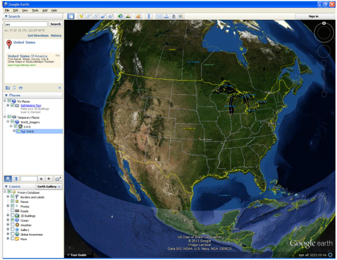
**3. KML: **KML (Keyhole Markup Language) is an XML format for representing geographic data, which can be viewed and operated through applications such as Google Earth. KML files can contain a variety of geographic information under Mercator projection.
Pros
1. Angles remain unchanged: Mercator projection accurately preserves the angles between points on the earth, which is particularly useful for maritime and aviation navigation, which is important for calculating routes and headings.
**2. Straight routes: **In Mercator projection, both maritime and aviation routes appear as straight lines, which makes it easier to plan routes by calculating straight-line paths.
3. Intuitive display of longitude and latitude: Mercator projection converts longitude and latitude into straight lines, which is easy to understand and easy to mark and identify geographic locations when displayed.
Cons
1. Area distortion: The biggest disadvantage of the Mercator projection is that the area distortion becomes more and more serious as the latitude increases. Especially near the polar regions, the area on the map will be exaggerated. For example, Greenland looks almost as big as Africa in the Mercator projection, but its actual area is much smaller than Africa.
2. Latitude range limitation: The Mercator projection cannot accurately represent the polar regions. When the latitude exceeds 85°30′, the projection result will be very distorted and even exceed the representable range.
3. Limitations: Although the Mercator projection has advantages in sailing and navigation, it is not suitable for showing the accurate area distribution of the world, especially when used in scenes such as climate research and population distribution, distortion seriously affects the results.
Application Scenario
The Mercator projection is widely used in various scenarios where it is necessary to preserve angles or the straight nature of routes. The Mercator projection is often used in nautical charts and aeronautical charts because it can preserve angles. In these charts, routes are usually shown as straight lines to facilitate navigation calculations. When used for the global distribution of meteorological data, the Mercator projection can easily show weather patterns and systems in various regions. Although the projection is distorted in polar regions, it is still effective for displaying meteorological data in low and mid-latitude regions.
Example
- An overview of the Mercator projection.
- Mercator projection world map.

File Opening Mode
- Google earth mercator projection.
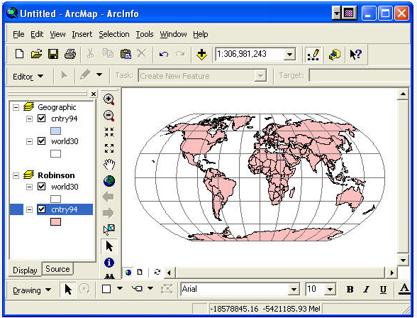
- ArcMap mercator projection.
Related GIS Projections
Longitude / Latitude Projection
Transverse Mercator Projection