
 Service


GPX(GPS eXchange Format)
GPX is an XML-based file format specifically designed for exchanging GPS data. It is widely used to describe location information, such as routes, tracks, and points of interest (POIs), making it easy to share and transfer data between different GPS devices and software. As an open standard, the GPX format is supported by many applications and devices, such as sports trackers, map software, and navigation systems.
2025-09-16 14:47:24
VCT(Vector Product Format)
**VCT **(Vector Product Format) is a vector data format commonly used in geographic information systems (GIS) and spatial data management. The format is designed to support data storage and exchange of complex geographic objects and provide efficient spatial data processing and application. The VCT format has attracted widespread attention for its flexibility and efficient storage structure, especially in scenarios where large amounts of spatial data need to be quickly queried and processed.
2025-09-16 14:47:24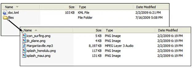
KMZ (Keyhole Markup Language Zipped)
KMZ is a file format for geospatial data and is a compressed version of a KML (Keyhole Markup Language) file. KML is a standardized markup language developed by Google for representing geospatial information and displaying it in mapping applications such as Google Earth and Google Maps. KMZ files reduce the file size by compressing the KML file and its associated resources (such as images and 3D models), making them easier to transfer and share.
2025-09-16 14:47:23

JSON (JavaScript Object Notation)
**JSON **(JavaScript Object Notation) is a lightweight data exchange format based on a subset of the JavaScript language and is widely used for data transmission and storage. JSON uses key-value pairs to represent data, using a simple, easy-to-read text format that is also easy to parse and generate, making it a universal data exchange format.
2025-09-16 14:47:22
GML (Geography Markup Language)
**GML **(Geography Markup Language) is an XML standard defined by the Open Geospatial Consortium (OGC) for storing and exchanging geographic information. As one of the core standards for geographic information systems (GIS) and spatial data infrastructure (SDI), GML provides a universal, text-based encoding method for complex geographic data models. It allows users to describe geometric shapes (such as points, lines, polygons), geographic features, attributes, and topological relationships, facilitating data sharing and interoperability between different systems.
2025-09-16 14:47:22
GeoJSON
GeoJSON is a geospatial data format based on the JSON (JavaScript Object Notation) standard, used to represent simple geographic features and their attributes. It stores geographic data (such as points, lines, polygons, etc.) together with related attribute information, and is widely used in Web map services, GIS (Geographic Information System), data visualization, and geographic data exchange.
2025-09-16 14:47:21
SHX(Shapefile Index)
SHX (Shape Index) files are a file format in Geographic Information Systems (GIS), mainly used to store the location and size information of all geometric objects in Shapefile files. SHX files are part of the Shapefile file format, a popular GIS data format developed by the Environmental Systems Research Institute (ESRI) to store the geometry and attribute information of geographic locations. SHX files are usually used together with SHP files (master files storing geometry information) and DBF files (dBASE tables storing attribute data), and the three together constitute a complete Shapefile dataset.
2025-09-16 14:47:20
DBF(DataBase File)
**DBF **(DataBase File) is a file format for storing data, first introduced by the dBASE database system. It is widely used as a storage method for attribute data in GIS file formats such as Shapefile, and can record the non-spatial attribute information of each spatial element, facilitating data analysis and query.
2025-09-16 14:47:19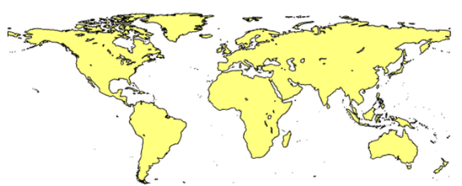
SHP(Shapefile)
SHP (Shapefile) is a commonly used GIS data format. It is a vector data format designed by ESRI (Environmental Science Research Institute) and can be used to store and edit various geographic information data, such as points, lines, and surfaces. SHP files are a binary-based format that contains the geometric information and attribute information of geographic entities.
2025-09-16 14:47:19