JPEG (Joint Photographic Experts Group)
JPEG (Joint Photographic Experts Group) is a file format widely used for digital image compression, with the extension “.jpg” or “.jpeg”. It was developed by the Joint Photographic Experts Group established in 1986 and was officially adopted as an international standard (ISO/IEC 10918-1) in 1992. JPEG mainly uses lossy compression, which can significantly reduce the size of image files with a high compression rate. Therefore, it is widely used in digital cameras, websites, social media and other fields.
2025-09-16 14:47:58BMP (Bitmap Image File)
BMP file (bitmap file, extension: .bmp) is a file format for storing bitmap images, developed by Microsoft. It is widely used as a standard image format in Windows environment, mainly used to process uncompressed raster images. Since BMP files store each pixel data of the image as it is, they can display high-quality and lossless images, but the file size is often large.
2025-09-16 14:48:00SketchUp
SketchUp is a 3D modeling software developed by Trimble, with the core concept of “making 3D modeling as natural as sketching with a pencil”. It significantly lowers the threshold of 3D design through a minimalist interface and intuitive push-pull modeling tools (such as drawing lines to create surfaces and extruding to create bodies), and is suitable for quickly building solution prototypes in the fields of architecture, interior design, and landscape. Its unique advantage lies in the balance between professionalism and ease of use. 80% of users can master basic operations within 3 hours.
2025-09-16 14:48:19WP
**WP **files are a specific file format for managing and displaying 3D tile data and spatial information. This format is mainly used in geographic information systems (GIS) and 3D visualization platforms, and is designed to efficiently display and distribute large-scale geographic data and city models. WP files store sliced 3D models and texture information, and are suitable for managing and distributing large-scale geographic data sets. Especially in Web-based geographic information visualization and real-time rendering, WP files are widely used due to their lightweight and high-speed display characteristics.
2025-09-16 14:47:57HDF (Hierarchical Data Format)
HDF (Hierarchical Data Format) is a file format used to store and manage large scientific data sets. It is a container for multidimensional arrays and complex data structures, and is widely used in science, engineering, and research. It can store many types of data, including numerical values, images, audio, text, etc. It supports hierarchical structures, allowing data sets to be stored and accessed in a multi-level organizational manner, facilitating data organization, retrieval, and analysis.
2025-09-16 14:47:37KMZ (Keyhole Markup Language Zipped)
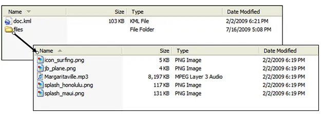
KMZ is a file format for geospatial data and is a compressed version of a KML (Keyhole Markup Language) file. KML is a standardized markup language developed by Google for representing geospatial information and displaying it in mapping applications such as Google Earth and Google Maps. KMZ files reduce the file size by compressing the KML file and its associated resources (such as images and 3D models), making them easier to transfer and share.
2025-09-16 14:47:233DD (ArcGlobe 3D Data)
3DD file format is a file format designed for 3D geographic information systems (3D GIS) to store 3D scene data. 3DD files are usually generated by GIS software (such as Esri’s ArcGIS Pro) and are a special format that integrates 3D geographic spatial information, model data, and related metadata. It can effectively support 3D visualization, spatial analysis, and scene management, and is an important tool for 3D GIS and virtual reality (VR) applications. The core advantage of 3DD files lies in their efficient organization and management of 3D geographic data, which is suitable for complex urban modeling, environmental simulation, and spatial analysis scenarios.
2025-09-16 14:47:45
 Service

