GeoDatabase
GeoDatabase is a geographic database used to store and manage geospatial data. It is a database format developed by Esri and is widely used in the field of GIS (Geographic Information System). GeoDatabase takes spatial data as its core and can store various geographic features and attribute information, such as maps, terrain, land use, road networks, water areas, etc. It supports a variety of data types, including points, lines, surfaces, rasters, topology, etc., and can accurately represent and process the location, shape and attributes of geographic objects.
2025-09-16 14:47:53FBX (FilmBox)
FBX (FilmBox) is a file format for 3D models, animations, and scenes. It is a universal exchange format developed by Autodesk for sharing and transferring data between different 3D software. The FBX format supports a variety of elements including geometric shapes, materials, animations, bones, etc., and can preserve the associations and hierarchical structures between these elements.
2025-09-16 14:47:59IGES (Initial Graphics Exchange Specification)
**IGES (Initial Graphics Exchange Specification) **is an intermediate file format for exchanging geometric data such as drawings and 3D models between CAD (Computer-Aided Design) systems. It was established by the American National Standards Institute (ANSI) in 1980 with the aim of ensuring compatibility between different CAD software. It has been widely used as a standard format for sharing and reusing design data of parts and structures between vendors, especially in the manufacturing and mechanical design industries.
2025-09-16 14:48:16MXD (Map Exchange Document)
MXD (Map Exchange Document) is a map document file format in Esri ArcGIS software. MXD files contain map layers, symbols, annotations, legends, and other information, as well as map view settings and map layouts. It is a binary file format used to store and share geospatial data and map designs.
2025-09-16 14:47:37STYL
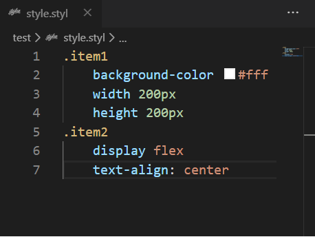
STYL files are the file format used by the Stylus preprocessor, which is a CSS preprocessor designed to improve the readability and maintainability of CSS. It uses a more concise and flexible syntax, supports indented syntax, omits symbols such as braces and semicolons, and makes style sheets clearer and easier to write. STYL files usually have a “.styl” file extension.
2025-09-16 14:47:38SBX (Shapefile Index)
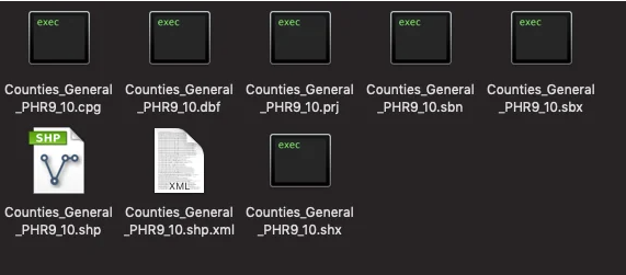
SBX (Shapefile Index (.sbx)) is an index file used in GIS (Geographic Information System) to improve the access speed of Shapefile (vector data storage format) data. It is a common vector data format used to store geospatial data. It consists of multiple files, including .shp, .shx and .dbf files. Among them, the .shx file is the SBX file, which stores the offset and length information of each geometric object in the .shp file in binary format.
2025-09-16 14:47:58LYR (Layer File)
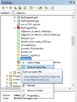
LYR files are a special file format used in Esri ArcGIS software to save layer-related information, usually with a .lyr extension. It does not directly store geographic data, but records information such as the layer’s style, rendering rules, data source path, and display configuration. The main function of LYR files is to associate complex map symbolization, display settings, and data, so that users can quickly apply consistent layer styles in different projects or scenes. In ArcGIS Pro, the function of LYR files is further expanded to LYRX files (ArcGIS Pro layer files), which are compatible with more modern GIS data formats and functions.
2025-09-16 14:47:46VDC(Virtual Design and Construction)
VDC (Virtual Design and Construction) is a technology and methodology used in the fields of architecture, engineering and construction (AEC). It combines building information modeling (BIM), 3D visualization and other digital tools to perform virtual simulation and management during the design, planning and construction stages of a project. By digitizing the construction process of the entire project, VDC can optimize collaboration, improve efficiency and reduce risks, thereby increasing the success rate and profitability of the project.
2025-09-16 14:47:24IND(Interchange of Navigational Data)
IND (Interchange of Navigational Data) is a data exchange format used in the field of navigation and is also a data format in GIS. IND files usually contain nautical charts and navigation-related data, such as routes, ship positions, port information, navigation marks, etc.
2025-09-16 14:47:26VCT(Vector Product Format)
**VCT **(Vector Product Format) is a vector data format commonly used in geographic information systems (GIS) and spatial data management. The format is designed to support data storage and exchange of complex geographic objects and provide efficient spatial data processing and application. The VCT format has attracted widespread attention for its flexibility and efficient storage structure, especially in scenarios where large amounts of spatial data need to be quickly queried and processed.
2025-09-16 14:47:24
 Service


