
 Service

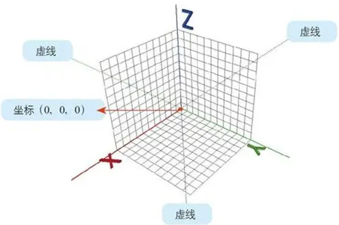
Geodetic Coordinate System 2002(GCJ-02)
Geodetic Coordinate System 2002, also known as GCJ-02 or nonlinear confidentiality processing technology for topographic maps, is a coordinate system for geographic information systems developed by the China National Administration of Surveying, Mapping and Geoinformation in 2002. It is an encryption algorithm for longitude and latitude data. By adding random deviations, the real coordinates are encrypted into false coordinates to achieve the confidentiality of geographic information. The Mars coordinate system is widely used in domestic map services, such as Amap and Baidu Maps, which must use this coordinate system to encrypt geographic locations.
2025-09-16 14:47:07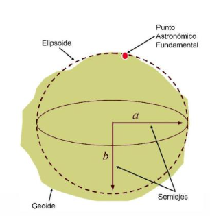
European Datum 1950 | EPSG:4230 (ED50)
ED50 is a European geodetic datum established in 1950. It is based on the overall adjustment of the European triangulated network and adopts Clarke ellipsoid parameters. It is mainly used for topographic surveying, mapping and early geographic information system (GIS) applications in Europe.
2025-09-16 14:47:07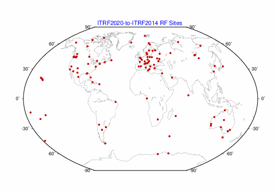
ITRF2020 (International Terrestrial Reference Frame 2020)
ITRF2020 (International Terrestrial Reference Frame 2020) is the latest earth reference frame officially released by the International Earth Rotation and Reference Systems Service (IERS) in 2022. The ITRF series is designed to define positions and motions on the earth with high precision. ITRF2020 is the successor to the traditional ITRF2014, and its updates are designed to improve the accuracy of observation techniques and respond to crustal movements. The reference frame is constructed from data from four observation techniques: VLBI (Very Long Baseline Interferometry), SLR (Satellite Laser Ranging), GNSS (Global Navigation Satellite System) and DORIS (Doppler Orbiting Integrated with Radio Positioning).
2025-09-16 14:47:07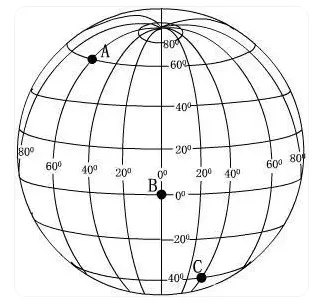
Baidu Coordinate System (BD09)
Baidu Coordinate System (BD09), also known as Baidu Coordinate System, is a coordinate system developed by Baidu to meet the special needs of geographic information systems in mainland China. It is encrypted based on the WGS84 coordinate system (World Geodetic System 1984) to ensure accurate geographic positioning services within mainland China.
2025-09-16 14:47:06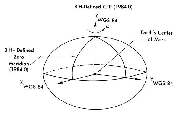
GPS Coordinate System (WGS Coordinate System | EPSG:4326)
GPS Coordinate System, that is, the coordinate system used by the Global Positioning System, is usually based on the geographic coordinate system (EPSG:4326) WGS84 (World Geodetic System 1984). This is a universal reference system used to determine the longitude and latitude of any point on the earth. WGS84 is a geocentric coordinate system with the center of mass of the earth as the origin. It is widely used in navigation, surveying, mapping and geographic information systems (GIS).
2025-09-16 14:47:06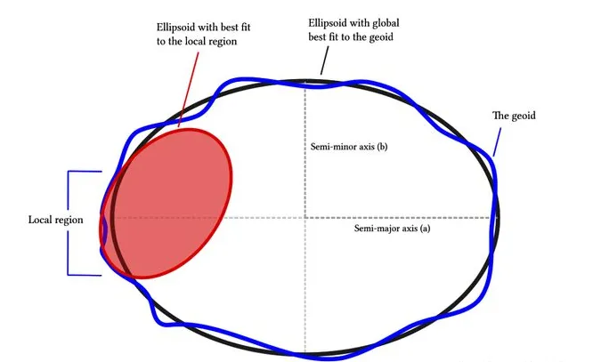
Projected Coordinate System
A projected coordinate system is a plane coordinate system whose map units are usually meters or kilometers. It is obtained from the projection of the earth’s approximate ellipsoid and corresponds to a geographic coordinate system. A projected coordinate system uses a coordinate system based on X and Y values to describe the location of a point on the earth.
2025-09-16 14:47:05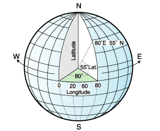
Geographic Coordinate System(GCS)
Geographic Coordinate System (GCS) is a coordinate system based on a sphere or ellipsoid that is used to define locations on the surface of the Earth. It describes a location using two angular coordinates (usually latitude and longitude), and the third value can be an optional altitude value. GCS is widely used in fields such as geographic information systems (GIS), mapping, and navigation, and is the basis for expressing geographic data.
2025-09-16 14:47:05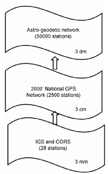
China Geodetic Coordinate System 2000(CGCS2000)
The 2000 coordinate system, namely the China Geodetic Coordinate System 2000 (CGCS2000 for short), is a new generation of geocentric coordinate system released by the National Administration of Surveying, Mapping and Geoinformation of China in 2008, replacing the Xi’an 1980 coordinate system. CGCS2000 adopts the standard of the International Terrestrial Reference Frame (ITRF) and is highly compatible with the WGS84 coordinate system (the earth coordinate reference system used worldwide). Its geodetic datum is based on the GRS80 ellipsoid (the 1980 International Reference Ellipsoid), with accurate geocentric positioning, and is suitable for various precise measurements and geographic information processing.
2025-09-16 14:47:05