OGC GeoPackage
GeoPackage is a lightweight, high-performance geospatial information exchange and storage format standardized by the Open Geospatial Consortium (OGC). Unlike traditional multi-file formats such as Shapefile or GeoTIFF, GeoPackage stores all spatial and attribute data in a single SQLite database file (.gpkg extension). GeoPackage is designed for mobile devices and web applications, and is particularly suitable for environments with limited storage capacity and performance.
2025-09-16 14:48:04MDB(Microsoft Access Database)
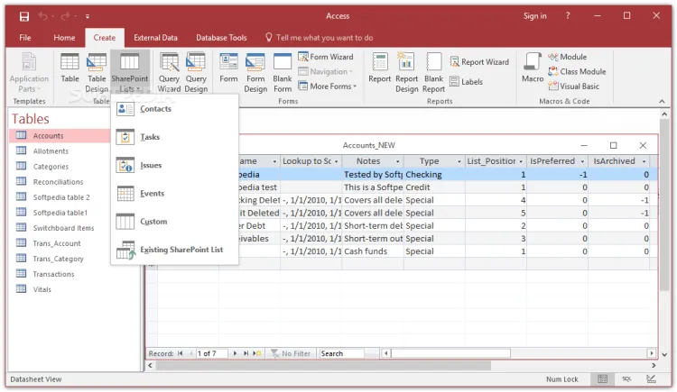
In GIS, MDB refers to the extension of Microsoft Access Database files, which are used to store geospatial data and attribute data. MDB files are a common GIS data format that can contain geographic information such as vector data, raster data, attribute tables, and relationships. By using MDB files, GIS software can read and process geospatial data to perform operations such as map making, spatial analysis, and data query.
2025-09-16 14:47:34Van der Grinten Projection
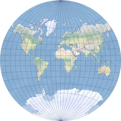
Van der Grinten projection is a world map projection developed by American geographer Alphons J. van der Grinten in 1898. The notable features of this projection are that it can represent the entire earth in a circle and present a visually balanced and elegant world map by depicting the meridians and parallels as curves.
2025-09-16 14:47:04E01
E01 file is a dedicated data archive file format used to store and transmit large-scale GIS data sets. It was developed by Esri to improve the performance and efficiency of GIS data. The E01 file uses a binary format and has a high compression rate, which can organize a large amount of geographic data in a single file. E01 files are usually used to store raster data, vector data, topological data, attribute data, etc. It also supports data indexing and querying to speed up data access and analysis.
2025-09-16 14:47:38CH1903 (Swiss Coordinate System 1903 | EPSG:4149)
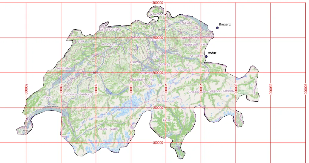
CH1903 is the widely used national coordinate system of Switzerland, based on the geodetic datum established in 1903. It is a projection coordinate system covering the whole of Switzerland, developed to enable precise geospatial information management and mapping of a country with mountainous terrain. The reference ellipsoid used is Bessel 1841, and the projection method is the Oblique Mercator Projection. This coordinate system has long been used by the Swiss National Cartographic Office (Swisstopo) and has become a standard in many fields such as topographic mapping, surveying, civil engineering and infrastructure planning. In recent years, Switzerland has gradually transitioned to the higher-precision CH1903+ (EPSG:2056) coordinate system, but a large amount of historical data is still stored based on CH1903.
2025-09-16 14:47:11Parasolid
Parasolid is a core technology of Siemens for accurate geometric modeling that is widely used in the fields of 3D computer-aided design (CAD), computer-aided engineering (CAE) and computer-aided manufacturing (CAM). It also plays an important role in GIS (Geographic Information System) processing of complex spatial data scenes involving high-precision 3D terrain, building models, etc. It stores and exchanges accurate geometric information of 3D models in a neutral file format, providing strong support for data interaction between different software.
2025-09-16 14:48:16Autodesk Maya
Autodesk Maya is a professional-grade 3D computer graphics software developed and provided by Autodesk. It is widely used in industries such as film, animation, games, commercials, and architectural visualization, and is suitable for scenes that require high-level 3D modeling, animation, rendering, and simulation.
2025-09-16 14:48:14RVT (Revit Project File)
RVT files are the native file format used by Revit, a BIM (Building Information Modeling) software developed by Autodesk. The format is designed to comprehensively manage and share information on architectural, structural, MEP (mechanical, electrical, plumbing) engineering projects, and store all data in the building life cycle, including 3D models, parametric data, drawings, material information, etc. RVT files are saved in a binary format and are widely used for design change management, collaboration, and visualization. It is highly compatible with Autodesk products and has become the standard BIM file format for the construction industry.
2025-09-16 14:47:49PRJ (Projection)
**PRJ **(Projection) file is one of the common file formats in Geographic Information System (GIS), which is used to store spatial reference information and coordinate system definition. PRJ is the abbreviation of Projection, which is usually used with other geographic data files (such as vector data, raster data, etc.) to determine the geographic location and coordinate system of the data.
2025-09-16 14:47:58
 Service


