 Service


Nextzen / Mapzen Turn-by-Turn API
Nextzen / Mapzen Turn-by-Turn API is an open-source navigation service that supports multiple modes of transportation including car, bicycle, walking, and public transit. It is used to integrate route planning, navigation instructions, and travel time estimation into web or mobile applications. It provides dynamic route calculation and real-time navigation capabilities, allowing developers to implement draggable waypoints and obtain text-based navigation instructions in Leaflet maps via plugins such as lrm-mapzen. Since the Mapzen service has been shut down, Nextzen, as its successor, offers a similar API integration solution, including routing and map data services.
2026-04-24 16:34:56
Cesium Ion API
Cesium Ion API is a cloud interface service provided by the Cesium platform for accessing its hosted global geospatial data, such as high-precision terrain, imagery, and 3D models. It uses an Access Token for authentication, allowing developers to call this API within their applications to quickly load high-quality 3D geographic data and achieve immersive globe visualization. It also supports users in uploading and managing their own spatial data assets, which can then be published and shared via the API.
2026-04-24 16:29:27
Gaode LBS Cloud
Gaode LBS Cloud is a spatiotemporal intelligence platform for the industrial sector under the Gaode Map brand. Leveraging the "Yunrui" spatiotemporal industry large model and the "Yunjing" 3D reconstruction platform, it provides intelligent solutions based on spatiotemporal data for industries such as offline retail, transportation, logistics, energy, and finance. Integrating AI with spatial intelligence technologies, it supports dynamic 3D urban reconstruction and intelligent decision-making, helping enterprises achieve full-chain digital upgrades in site selection, operations, and dispatching. Starting in 2024, the platform has fully opened its development capabilities and has established its first Spatiotemporal Smart City Operations Center in Quzhou.
2026-04-24 16:22:55
Tencent Maps API
Tencent Maps API (Tencent Map Location Service Platform) is a location service interface provided by Tencent. Developers can call its capabilities for mapping, positioning, route planning, place search, etc., via multiple technical platforms such as JavaScript, Android, and iOS, enabling rapid integration of map functionality into applications or websites. The API supports free Key application with no call frequency limits and is widely used in industries such as mobility, logistics, and retail, offering high-precision positioning, real-time traffic conditions, reverse geocoding, and a wealth of other features. The platform also provides visualization tools and data services to support enterprise digital transformation.
2026-04-24 16:12:43
Alibaba Cloud AMap (AutoNavi) Open Platform API
Alibaba Cloud AMap (AutoNavi) Open Platform API is a standardized set of location service interfaces provided by Alibaba Group. It integrates core capabilities such as map display, geocoding, route planning, real-time traffic conditions, place search, positioning, and weather queries. The API supports integration across multiple platforms including Web, Android, iOS, and HarmonyOS, allowing developers to embed high-precision geographic information and intelligent navigation capabilities into various applications. Underpinned by Alibaba Cloud infrastructure, it ensures stable performance under high global concurrency and is widely used in digital scenarios such as mobility, logistics, smart hardware, and e-commerce.
2026-04-20 15:47:40
Azure Maps API
Azure Maps API is a set of geospatial services provided by the Microsoft Azure cloud platform. Through REST APIs and a Web SDK, it offers developers capabilities such as map rendering, geocoding, location search, route planning, real-time traffic conditions, time zone information, geolocation services, and weather data integration. It helps build intelligent location solutions for web and mobile applications and is widely used in logistics, asset tracking, IoT monitoring, and mobility services.
2026-04-20 15:39:38
LocationIQ API
LocationIQ API is a cloud-based web API service for searching, converting, and visualizing geospatial data. It primarily provides functions such as geocoding (address → coordinate conversion), reverse geocoding (coordinate → address conversion), map tile delivery, routing, and location search. Built on OpenStreetMap (OSM) data, it is characterized by its ability to build high-precision, low-cost location-based services. With its lightweight and simple REST API design, it integrates easily into web and mobile applications, making it suitable for developing a variety of location-based services.
2026-03-31 10:50:12
Geoapify Maps & Location API
Geoapify Maps & Location API is a cloud-based geolocation service that provides functionalities such as map display, geocoding, routing, and place search. Built on OpenStreetMap data, it is designed to enable developers to easily integrate mapping features into web and mobile applications. With its flexible API design and simple authentication method, it supports the development of a wide range of location-based applications and is used as a scalable platform suitable for commercial use.
2026-03-26 18:49:35
Stadia Maps API
Stadia Maps API is a cloud-based map service API for delivering map tiles and geospatial data. By using this API, developers can easily integrate high-quality map display functionality into websites and mobile applications. Stadia Maps is characterized by its ability to deliver both vector and raster tiles, providing fast distribution of map styles based on open data such as OpenStreetMap. It is also compatible with common map libraries, enabling flexible customization and high-performance map rendering. With its lightweight and scalable cloud infrastructure, it plays an important role in the development of geospatial applications.
2026-03-26 18:39:58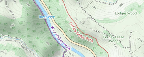
Thunderforest Maps API
Thunderforest Maps API is a collective term for the map delivery services provided by Thunderforest, offering an API that allows for the rapid integration of high-quality maps into web and mobile applications. It is accessed using an API key and provides multiple services, including standard map style delivery, raster tiles, static maps, vector styles, and vector sources. It features map styles such as OpenCycleMap, Transport, Landscape, Outdoors, and Atlas, and is easy to integrate with existing map libraries.
2026-03-26 18:44:46