 Service

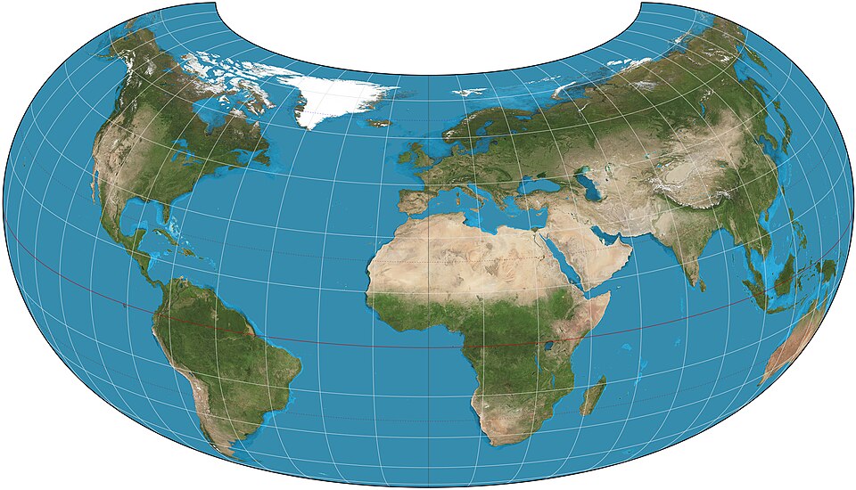
Armadillo Projection
Armadillo Projection is a relatively new world map projection designed to represent the entire Earth on a single plane in a visually striking manner. It prioritizes visual continuity and artistic expression over geometric accuracy, featuring a unique shape that appears to wrap around the globe. Primarily used for educational purposes, design, and visualization, it is known as a projection that offers a fresh perspective on presenting geographic information.
2025-12-29 14:31:07
Balthasart Cylindrical Projection
Balthasart Cylindrical Projection is a map projection method belonging to the cylindrical projection family. Cylindrical projections involve projecting the spherical surface onto a cylindrical surface, which is then unfolded, resulting in both meridians and parallels appearing as straight lines that intersect orthogonally. In this projection, the direction does not necessarily have to align with the Earth's axis (meaning the line of tangency between the sphere and the cylinder is not necessarily the equator), as any angle is possible. Based on the relative orientation of the projection surface to the Earth, it can be categorized into normal-axis, transverse-axis, oblique-axis cylindrical projections, as well as tangent and secant cylindrical projections. In the normal-axis projection, parallels are straight parallel lines, while meridians are straight parallel lines equally spaced and perpendicular to the parallels. The Balthasart Cylindrical Projection is primarily used for drawing world or regional maps, especially for index maps. It is suitable for low-latitude regions near the equator, while transverse or oblique-axis cylindrical projections are better suited for areas extending along a meridian or a specific great circle direction.
2025-12-29 14:24:06
Geocodio API
Geocodio API is a geocoding service API primarily used to convert addresses into latitude and longitude coordinates (geocoding) or convert latitude and longitude coordinates into addresses (reverse geocoding). It supports various programming languages through HTTP requests and returns data in JSON or XML formats, widely used in map applications, location services, data analysis, and other scenarios.
2025-12-29 14:16:29
Pelias/geocode.earth API
Pelias/geocode.earth API is an open-source geocoding service that provides bidirectional conversion between addresses and coordinates. It supports forward geocoding (finding location coordinates from an address) and reverse geocoding (retrieving specific location information from coordinates), and includes structured geocoding capabilities to handle segmented data (such as house numbers, streets, etc.). The API also offers autocomplete functionality, providing real-time suggestions for location names and returning detailed information including names, addresses, and coordinates. Its typical application scenarios include providing precise address search for mapping services, enabling real-time location navigation for mobile applications, and converting address data into geographic coordinates for spatial analysis.
2025-12-29 14:10:55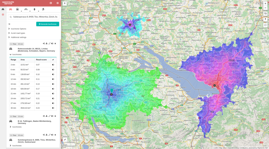
OpenRouteService API
OpenRouteService API is an application programming interface (API) that provides route planning, navigation, and geocoding services. It supports multiple transportation modes (such as walking, cycling, driving, etc.) and can be integrated into map applications to enable route calculation and navigation functionality. Through its open interface, it offers location-based services for developers, making it suitable for application development requiring route optimization or navigation features.
2025-12-29 14:05:48
GraphHopper Directions API
GraphHopper Directions API is a route planning and navigation service based on a RESTful architecture, provided by GraphHopper GmbH. It leverages OpenStreetMap data to provide global map coverage and supports route calculation for multiple modes of transportation (such as driving, cycling, walking, public transit, etc.). It integrates functionalities like real-time traffic information, route optimization, geocoding, and isochrone analysis. Developers can quickly integrate it into applications using its Java or JavaScript clients. It is suitable for scenarios like logistics and distribution, traffic navigation, and geographic information systems, combining open-source flexibility with commercial-grade performance.
2025-12-29 14:00:14
OSRM API (Open Source Routing Machine)
OSRM API (Open Source Routing Machine) is a high-performance open-source routing engine based on OpenStreetMap data, providing route calculation services through RESTful HTTP interfaces. It supports multiple travel modes such as driving, cycling, and walking, and can quickly return the shortest path results. It is widely used in navigation application development, logistics delivery planning, travel time analysis, and other scenarios. Core features include route calculation, multi-point travel time matrix generation, GPS trajectory matching, etc., utilizing the Contraction Hierarchies algorithm to achieve millisecond-level response times.
2025-12-29 13:55:31
Esri Spatial Analysis / Geometry API
ESRI Spatial Analysis is the core spatial analysis toolkit within the ArcGIS platform, supporting advanced spatial modeling techniques such as terrain modeling, location analysis, pattern recognition, and change detection. The Geometry API provides geometric object processing capabilities, including point/line/polygon operations, spatial relationship analysis, and geometric calculations, with support for standard formats such as GeoJSON and WKT. Both are integrated into ArcGIS Pro and the Python API, require specific licenses (such as a Spatial Analyst license), and it is recommended to migrate from ArcGIS Desktop to ArcGIS Pro for use.
2025-12-29 13:48:22
Behrmann Cylindrical Equal-Area Projection
The Behrmann Cylindrical Equal-Area Projection is an equal-area azimuthal projection distinguished by its ability to accurately preserve distances and directions from a central point. By projecting each point on the Earth onto a flat surface, this projection method faithfully represents geographical features and relative positional relationships, making it widely applicable in fields such as cartography and geographic information systems.
2025-12-08 16:15:50
BAG (Bathymetric Attributed Grid)
BAG (Bathymetric Attributed Grid) is an open, standardized data format used for marine surveying and seabed terrain modeling, developed and maintained by the Open Navigation Surface Working Group. It employs an HDF5 container to organize data, with core components including the bathymetric grid elevation layer (storing seabed depth values) and the uncertainty layer (recording depth measurement errors), while also supporting embedded metadata (e.g., coordinate reference systems, acquisition device parameters) and optional layers (such as sounding point density and seabed classification). The format utilizes tile-based compression technology to optimize the storage and transmission efficiency of large-scale seabed terrain data and is compatible with multi-resolution pyramid structures. It is one of the marine bathymetric data exchange standards recommended by the International Hydrographic Organization (IHO).
2025-12-05 15:19:40