 Service

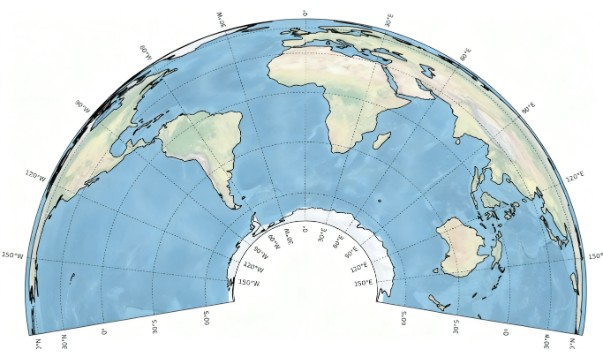
Albers Equal-area Conic Projection
Albers equal-area conic projection is an equal-area conic projection that utilizes two standard parallels. Compared to projections with only one standard parallel, this approach helps reduce distortion to some extent. It is best suited for mapping large continental areas extending predominantly in an east-west direction in the mid-latitudes and is commonly used for maps of the contiguous United States, Europe, and Australia.
2025-11-24 16:12:02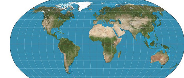
Robinson Projection
Robinson projection is a widely used map projection method developed since the 1960s, designed to represent the entire world on a single map. It seeks a practical compromise for displaying the whole Earth on a flat surface. Introduced in 1963 by Dr. Arthur H. Robinson, this projection features straight latitude lines and evenly spaced meridians, classifying it as a pseudocylindrical projection. While the central meridian is straight, all other meridians are curved. Robinson defined this projection by constructing a lookup table of Cartesian coordinates through specific interpolation of latitudes and longitudes, rather than using mathematical formulas.
2025-11-24 16:09:04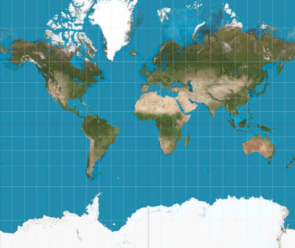
Mercator Projection
Mercator projection is a conformal tangent cylindrical projection devised by the Flemish cartographer Gerardus Mercator in 1569. It conceptually projects the Earth's surface onto a cylinder tangent at the equator, with a light source at the Earth's center casting surface features onto the cylinder. When unrolled, this creates a world map with the standard parallel at zero degrees (the equator).
2025-11-24 16:01:13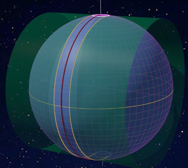
UTM Zone (Universal Transverse Mercator Coordinate System)
UTM Zone (Universal Transverse Mercator Coordinate System) is a coordinate system that converts latitude and longitude coordinates on the Earth's surface into a planar Cartesian coordinate system. It is widely used in map creation, engineering surveying, and military applications. Its core principle involves reducing distortion through zonal projection and achieving high-precision positioning through standardized coordinate representation.
2025-11-24 15:52:38
Esri GeoEvent Server
Esri GeoEvent Server is an enterprise-level software provided by Esri, designed for real-time processing, analysis, and dissemination of event-based geospatial data streams. It can connect to multiple real-time data sources, perform real-time analysis on event data through filters and processors, and deliver processed results to client applications, feature services, dashboards, or other destinations. This technology is commonly used in smart cities, traffic monitoring, and other scenarios requiring real-time responsiveness, helping users quickly adapt to dynamic changes.
2025-11-24 15:46:07_1763970235051.jpg)
MapQuest API
MapQuest API is an application programming interface that provides location-based services such as geocoding, route planning, and POI search. Developers can invoke its services by sending HTTP requests, for example, to convert addresses into coordinates or calculate driving routes. It supports multiple map data sources (e.g., OpenStreetMap, Bing Maps) and allows free access to basic services through an API key. This API is commonly used in scenarios like logistics optimization and location sharing. For instance, one organization utilized it to reduce meal delivery route planning time and costs.
2025-11-24 15:41:17
TomTom Maps SDK / Web API
TomTom Maps SDK / Web API is a toolkit integrated into web and mobile applications to build location-based service experiences. It provides map display, route planning, style customization, and data analysis capabilities, supporting multi-platform usage. The SDK allows developers to display multiple entity locations simultaneously on maps via API calls and leverages millions of data points collected by TomTom for efficient development. Compatible with both web-based and native mobile application platforms, it is suitable for various scenarios such as automotive navigation, public sector decision-making, autonomous driving, and logistics management.
2025-11-24 15:35:34
Carto Tiles API
CARTO Tiles API is an interface provided by the CARTO platform for efficiently processing and visualizing geospatial data. By splitting large datasets into pre-rendered tiles, it optimizes map loading speed and browsing experience, supporting various tile types such as dynamic and aggregated tiles. Built on the OGC API-Tiles standard, it integrates with CARTO’s declarative language, deck.gl, enabling flexible map styling and interactive application development.
2025-11-24 15:29:47
GeoJSONB (Binary GeoJSON)
GeoJSONB is a binary format used in PostgreSQL databases for storing GeoJSON data. It enables the database to handle geospatial data in a more compact and efficient manner. This format is supported by the PostGIS extension for PostgreSQL, which is a specialized geospatial database extension designed to enhance PostgreSQL's capabilities in managing location-based information.
2025-11-24 15:07:35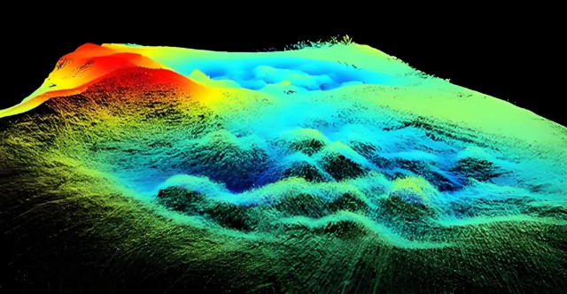
LAS/LAZ (LiDAR Point Cloud Format)
LAS/LAZ (LiDAR Point Cloud Format) files are standard formats for storing 3D point cloud data acquired through LiDAR technology, established by the American Society for Photogrammetry and Remote Sensing (ASPRS). The LAS format uses a binary structure to store attributes such as 3D coordinates (X, Y, Z), intensity, return number, and classification for each point. LAZ is a compressed version of LAS that significantly reduces file size while maintaining data integrity.
2025-11-24 14:57:18