 Service

_1762327884081.png)
Eckert Projection
Eckert projection is a general term for map projections invented by the German geographer Max Eckert in the early 20th century. He developed six projections (Eckert I to Eckert VI) with different characteristics, each of which represents the Earth's surface from a different perspective. These projections are mainly classified as pseudocylindrical projections, and Eckert IV and VI in particular are widely used in education and geographical materials due to their area accuracy (equal area) and good visual balance.
2025-11-05 15:30:28_1762327683829.png)
Gnomonic Projection
Gnomonic projection is a method in which a straight line is drawn from the center of the Earth to any point on the Earth's surface, and projected to the point where it intersects with a plane tangent to the Earth. This is a type of perspective projection (central projection), and has the characteristic that "great circle routes (shortest routes)" on the Earth are represented as straight lines after projection. For this reason, it is very useful when you want to show the shortest distance with a straight line.
2025-11-05 15:25:56_1762327491402.png)
Orthographic Projection
Orthographic projection is a map projection method that depicts the Earth as if seen from an infinite distance. It is used to maintain a certain degree of accuracy while maintaining a sense of depth when projecting a spherical surface onto a flat surface. It can reproduce the appearance of a part of the Earth as seen from space, allowing for realistic and beautiful map representations. This projection projects the Earth's surface onto a flat surface through a straight line drawn vertically from the center of the Earth, so it places more importance on a natural appearance and intuitive understanding than on the accuracy of distance and area.
2025-11-05 15:23:40_1762327362104.png)
Azimuthal Equidistant Projection
Azimuthal equidistant projection is a map projection that is drawn to accurately maintain direction and distance from a single point (reference point) on the Earth. Its greatest feature is that the straight-line distance and azimuth angle from the center point to all other points are accurately represented on the map. It is often used in applications where accuracy of direction and distance is important, such as air navigation and communications.
2025-11-05 15:21:19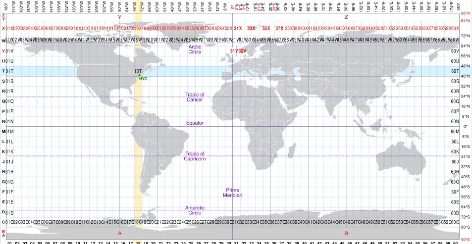
MGRS
MGRS coordinate system, also known as the Military Grid Reference System, is a standard coordinate system used by NATO military organizations. It is based on the Universal Transverse Mercator (UTM) system and further divides each UTM area into small squares of 100km x 100km. These blocks are identified by two connected letters, with the first letter representing the east-west position of the longitude zone and the second letter representing the north-south position.
2025-11-05 15:16:23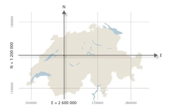
Swiss LV95
Swiss LV95 is a projection coordinate system adopted by the Swiss government, based on the CH1903+/LV95 standard, and is a variant of the Gauss Kruger projection designed specifically for planar surveying in the Swiss region. It solves the problem of direct use of spherical data in engineering and mapping by converting geographic coordinates (such as WGS84) into planar coordinates. This coordinate system is widely used in navigation, land management, and infrastructure planning in Switzerland, and its coordinate values are usually expressed in meters.
2025-11-05 15:14:49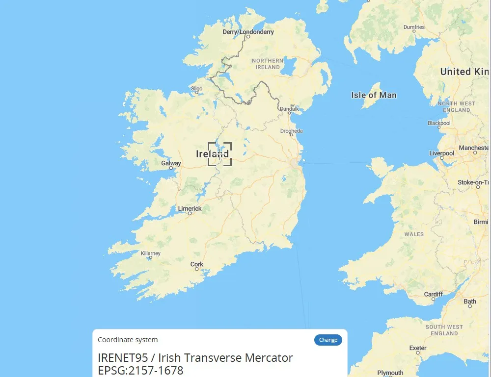
Irish Transverse Mercator
Irish Transverse Mercator (ITM) is a transverse Mercator projection coordinate system designed specifically for Ireland, using the ETRS89 ellipsoid as the reference. The central meridian of its projection is 8 degrees west longitude, and the geographic coordinates of the Irish region are converted into plane coordinates through the horizontal axis isometric cylindrical projection method to reduce deformation and meet national surveying and mapping needs. This coordinate system is the primary projection system for official maps and geospatial data of Ireland.
2025-11-05 15:13:00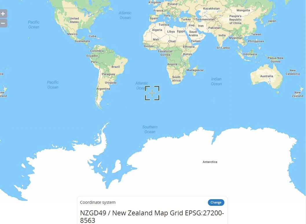
NZMG (New Zealand Map Grid – EPSG:27200)
New Zealand Map Grid (NZMG) coordinate system is a projected coordinate system used in New Zealand. Based on the Transverse Mercator projection, it is primarily used for mapping and georeferencing within New Zealand. It projects the Earth's surface onto a flat surface, centered on the South and North Islands of New Zealand. It uses specific central meridians and scale parameters to minimize projection distortion. This coordinate system is widely used in surveying, engineering, and land management in New Zealand. Coordinates are typically expressed in meters, with an origin near the South Island.
2025-11-05 15:11:00
Belgian Lambert 72 (EPSG:31370)
Belgian Lambert 72 is a regional geodetic coordinate system based on the Lambert Conformal Conic Projection used in Belgium. It is based on the Belgian geodetic datum established in 1972. This projection transforms the Earth's spheroid onto a flat surface and is suitable for mapping and geographic information system (GIS) applications in Belgium and the surrounding area. Its EPSG code is 31370. Unlike geocentric systems (e.g., WGS-84), this system is classified as a "local datum" because the center of the ellipsoid does not coincide with the Earth's center of mass.
2025-11-05 15:09:48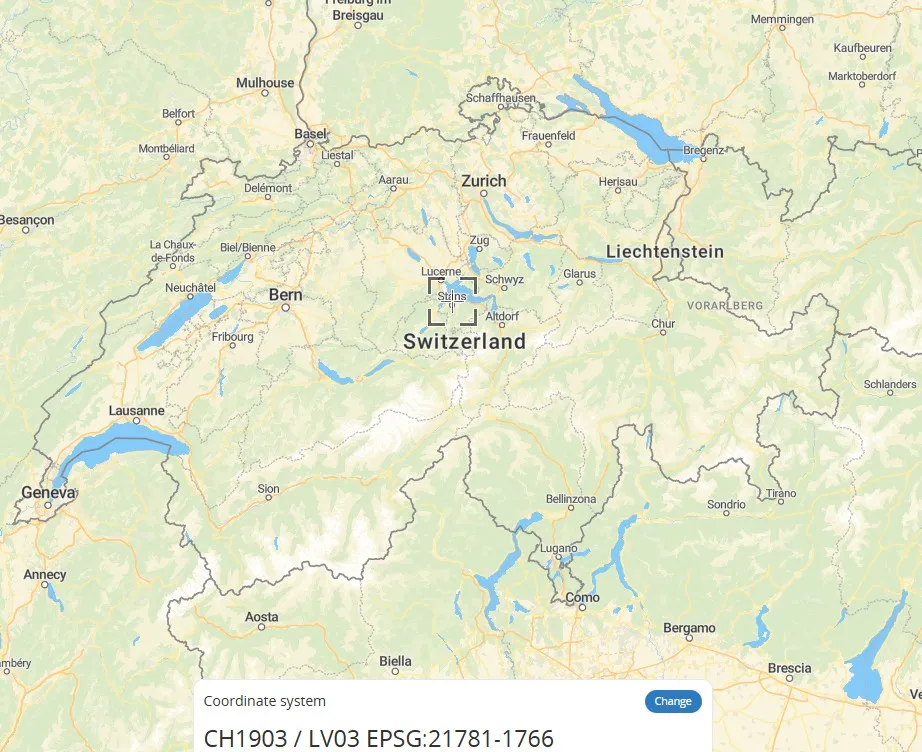
CH1903 / LV03 (Old Swiss National Coordinate System – EPSG:21781)
CH1903/LV03 is the national Cartesian coordinate system used by Switzerland. It uses the former Bern Observatory as its reference point (mandatory definition: 600,000 meters east longitude, 200,000 meters north latitude) and uses metric units to simplify positioning calculations. This coordinate system is based on the CH1903 geodetic datum. Its improved version, CH1903+, relocates the reference point to the Zimmerwald Observatory, but the coordinate error between the two is kept within 3 meters, making it suitable for mapping services throughout Switzerland. Unlike globally accepted geographic coordinate systems such as WGS84, CH1903 is a projected coordinate system that uses Cartesian (X, Y) coordinates to enable precise measurement of local areas.
2025-11-05 15:08:15