 Service

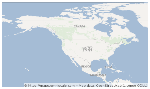
NAD27 (North American Datum 1927)
NAD27 (North American Datum 1927) is a geodetic datum established in 1927 for North America, defined based on the Clarke 1866 ellipsoid with its origin at Meades Ranch in Kansas, USA. This datum served as the official mapping and surveying standard for the United States, Canada, and Mexico for decades, widely used in historical topographic maps, land ownership records, and traditional geographic data. Although its accuracy is limited by early surveying technology and it has been superseded by more modern datums (e.g., NAD83), a significant number of historical archives and legacy systems still rely on NAD27. Therefore, special attention must be paid to datum transformations when dealing with older geographic data in North America.
2025-12-29 16:04:49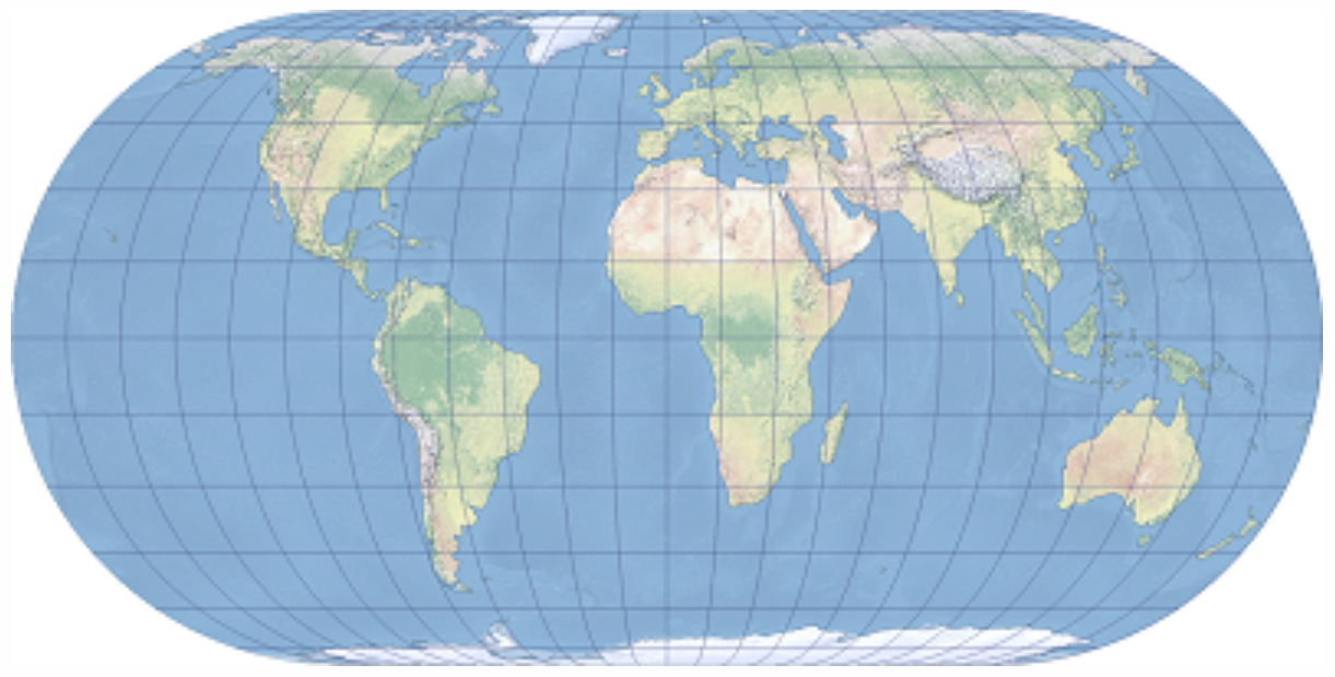
Eckert IV
Eckert IV (Eckert's Fourth Projection) is an equal-area map projection proposed in 1906 by German mathematician Max Eckert. Designed for representing the entire Earth on a world map, it accurately preserves area while distributing shape distortions relatively evenly. It is commonly used in GIS and thematic mapping for visually representing statistical data and distribution information. It is implemented by ESRI as ESRI:54012.
2025-12-29 15:03:20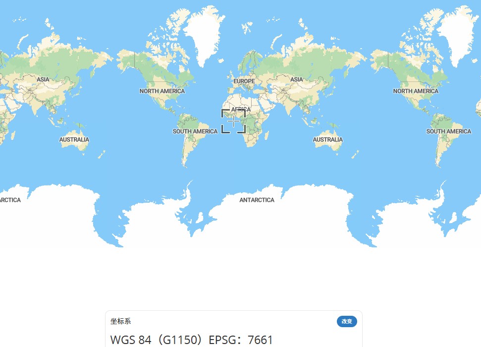
Compound CRS
A Compound CRS achieves unified representation of multi-dimensional spatial data by combining multiple coordinate reference systems (CRS). For example, it integrates a planar coordinate system (e.g., EPSG:7661) with an elevation system (e.g., EPSG:3855) to form a complete "planar + elevation" spatial description. Its core features include ensuring consistency between horizontal and vertical coordinate systems through associated parameters (such as ellipsoids and datums), making it suitable for fields requiring simultaneous expression of planar positions and elevations, such as terrain modeling and 3D GIS analysis. Technically, a Compound CRS typically comprises a horizontal CRS and a vertical CRS, unified through nested or associated parameters.
2025-11-24 16:19:55
Albers Equal-area Conic Projection
Albers equal-area conic projection is an equal-area conic projection that utilizes two standard parallels. Compared to projections with only one standard parallel, this approach helps reduce distortion to some extent. It is best suited for mapping large continental areas extending predominantly in an east-west direction in the mid-latitudes and is commonly used for maps of the contiguous United States, Europe, and Australia.
2025-11-24 16:12:02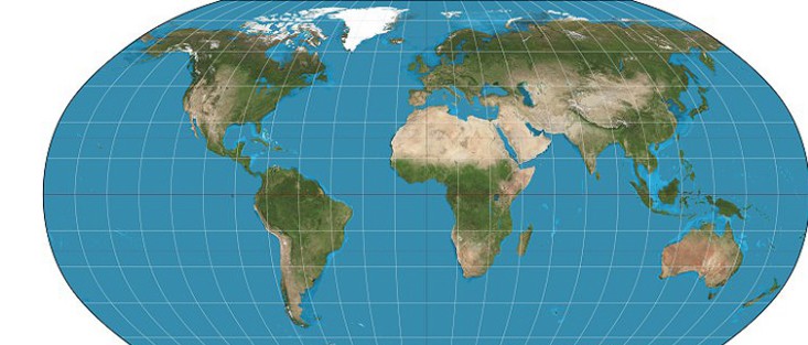
Robinson Projection
Robinson projection is a widely used map projection method developed since the 1960s, designed to represent the entire world on a single map. It seeks a practical compromise for displaying the whole Earth on a flat surface. Introduced in 1963 by Dr. Arthur H. Robinson, this projection features straight latitude lines and evenly spaced meridians, classifying it as a pseudocylindrical projection. While the central meridian is straight, all other meridians are curved. Robinson defined this projection by constructing a lookup table of Cartesian coordinates through specific interpolation of latitudes and longitudes, rather than using mathematical formulas.
2025-11-24 16:09:04
Mercator Projection
Mercator projection is a conformal tangent cylindrical projection devised by the Flemish cartographer Gerardus Mercator in 1569. It conceptually projects the Earth's surface onto a cylinder tangent at the equator, with a light source at the Earth's center casting surface features onto the cylinder. When unrolled, this creates a world map with the standard parallel at zero degrees (the equator).
2025-11-24 16:01:13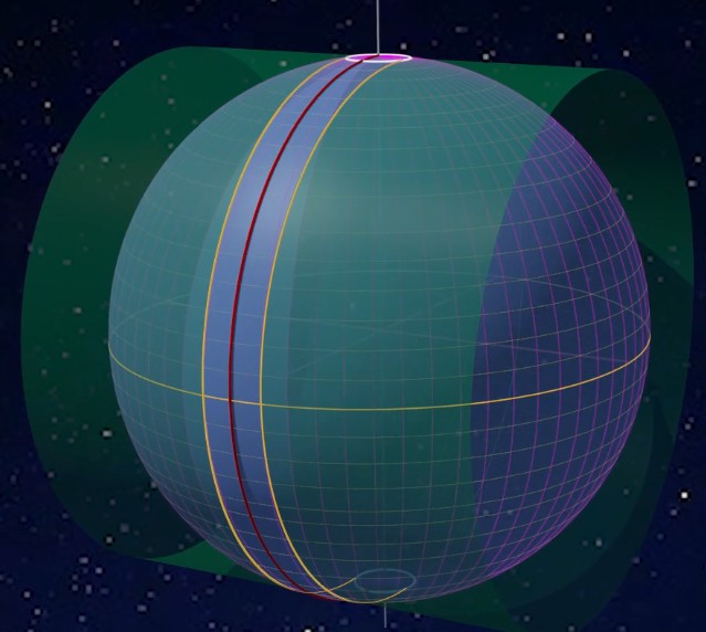
UTM Zone (Universal Transverse Mercator Coordinate System)
UTM Zone (Universal Transverse Mercator Coordinate System) is a coordinate system that converts latitude and longitude coordinates on the Earth's surface into a planar Cartesian coordinate system. It is widely used in map creation, engineering surveying, and military applications. Its core principle involves reducing distortion through zonal projection and achieving high-precision positioning through standardized coordinate representation.
2025-11-24 15:52:38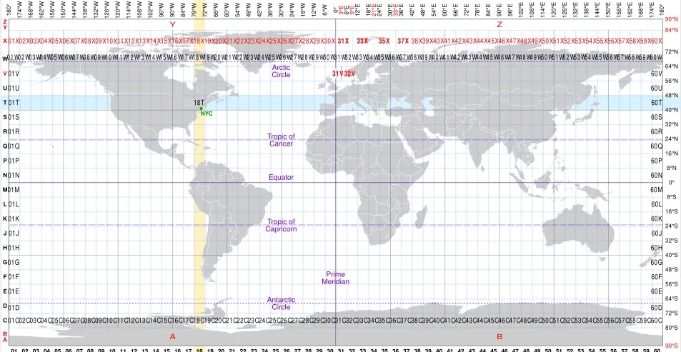
MGRS
MGRS coordinate system, also known as the Military Grid Reference System, is a standard coordinate system used by NATO military organizations. It is based on the Universal Transverse Mercator (UTM) system and further divides each UTM area into small squares of 100km x 100km. These blocks are identified by two connected letters, with the first letter representing the east-west position of the longitude zone and the second letter representing the north-south position.
2025-11-05 15:16:23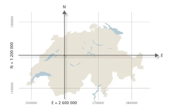
Swiss LV95
Swiss LV95 is a projection coordinate system adopted by the Swiss government, based on the CH1903+/LV95 standard, and is a variant of the Gauss Kruger projection designed specifically for planar surveying in the Swiss region. It solves the problem of direct use of spherical data in engineering and mapping by converting geographic coordinates (such as WGS84) into planar coordinates. This coordinate system is widely used in navigation, land management, and infrastructure planning in Switzerland, and its coordinate values are usually expressed in meters.
2025-11-05 15:14:49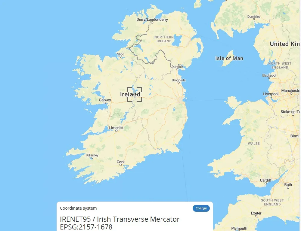
Irish Transverse Mercator
Irish Transverse Mercator (ITM) is a transverse Mercator projection coordinate system designed specifically for Ireland, using the ETRS89 ellipsoid as the reference. The central meridian of its projection is 8 degrees west longitude, and the geographic coordinates of the Irish region are converted into plane coordinates through the horizontal axis isometric cylindrical projection method to reduce deformation and meet national surveying and mapping needs. This coordinate system is the primary projection system for official maps and geospatial data of Ireland.
2025-11-05 15:13:00