Product Price
For more information on GISBox pricing, please click here.
1. Which features of GISBox are free?
1.1 Tiling
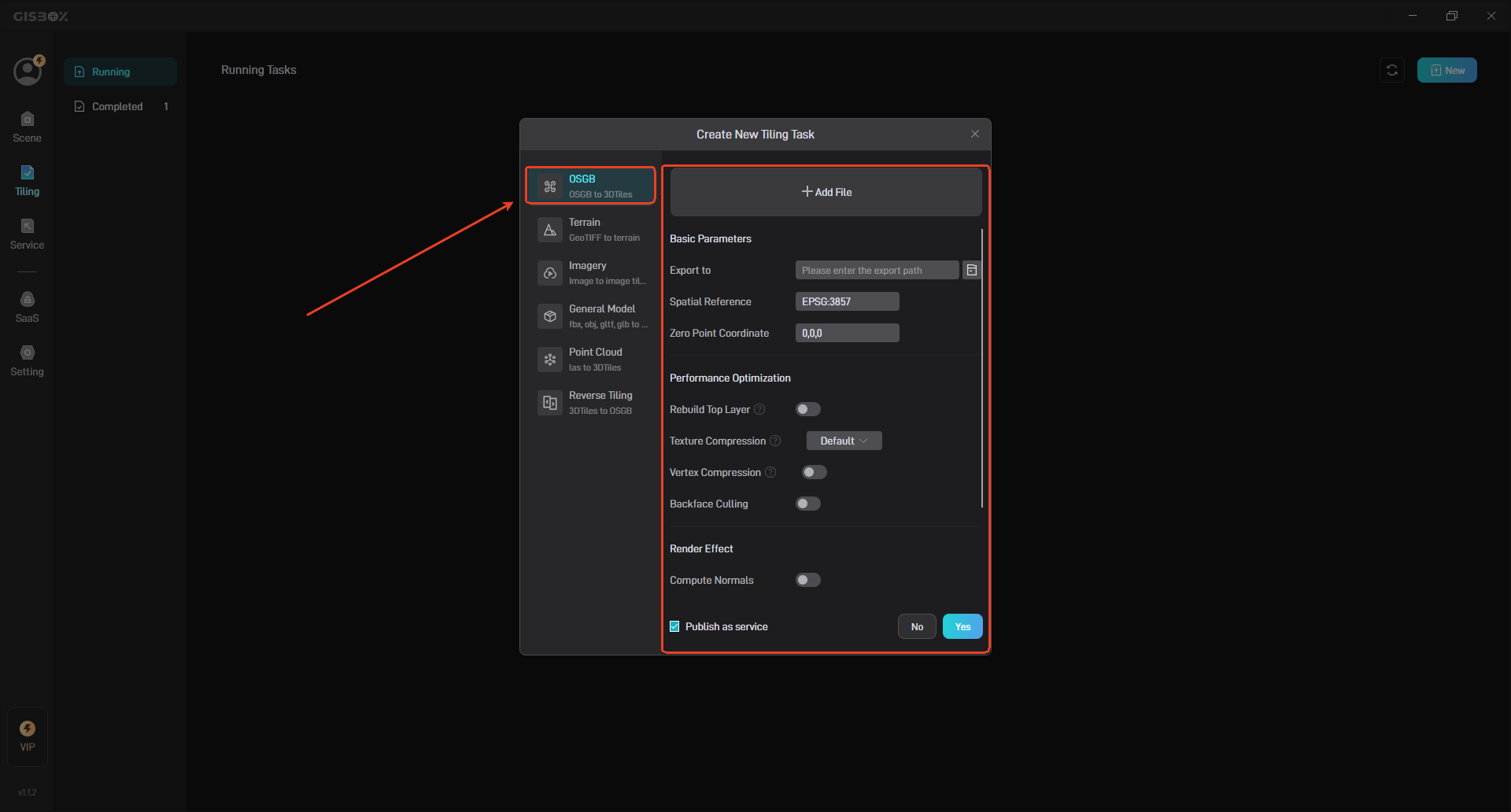
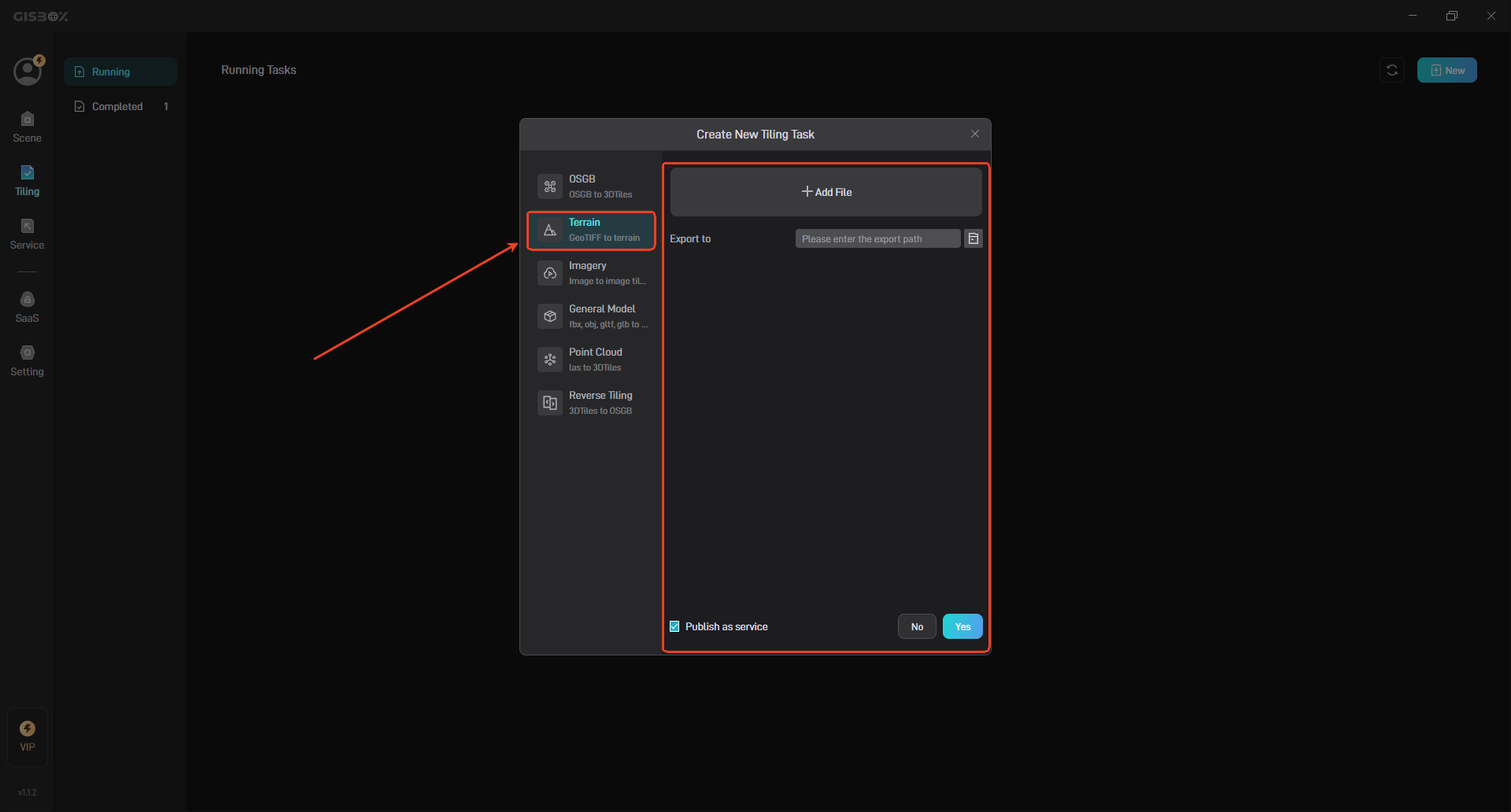
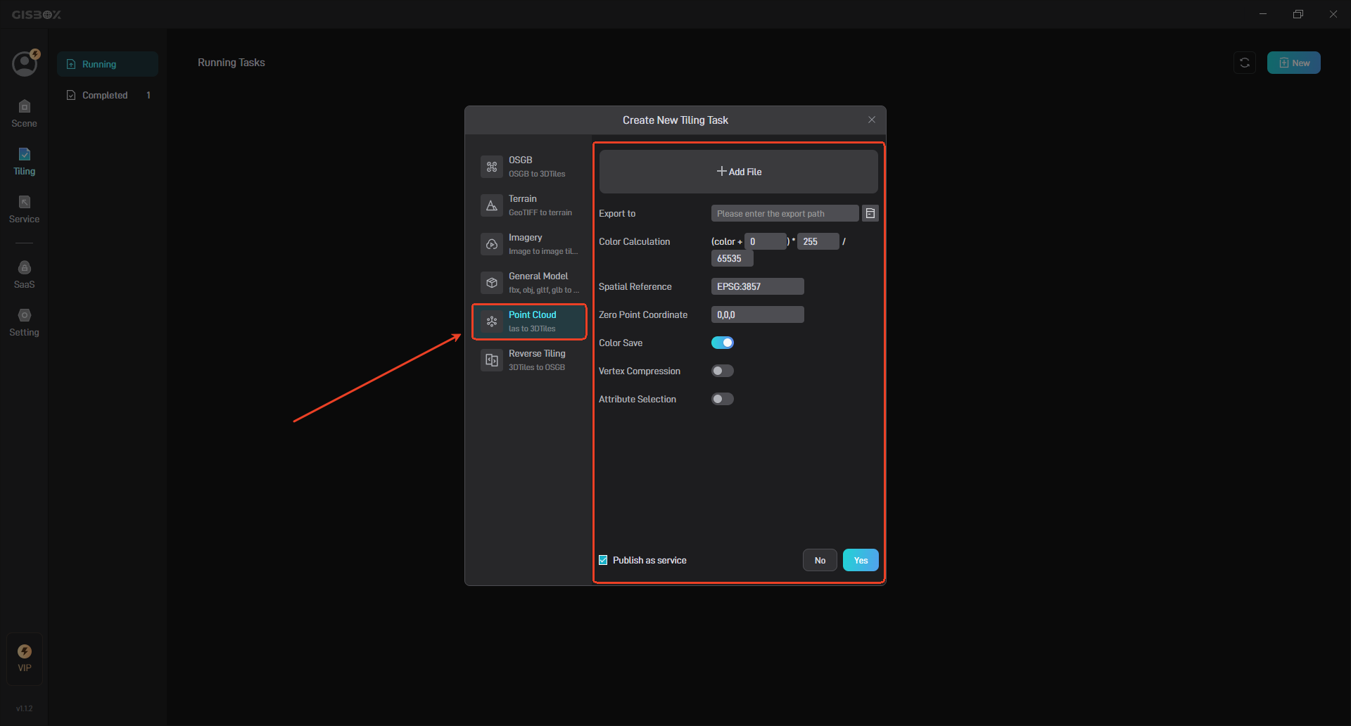
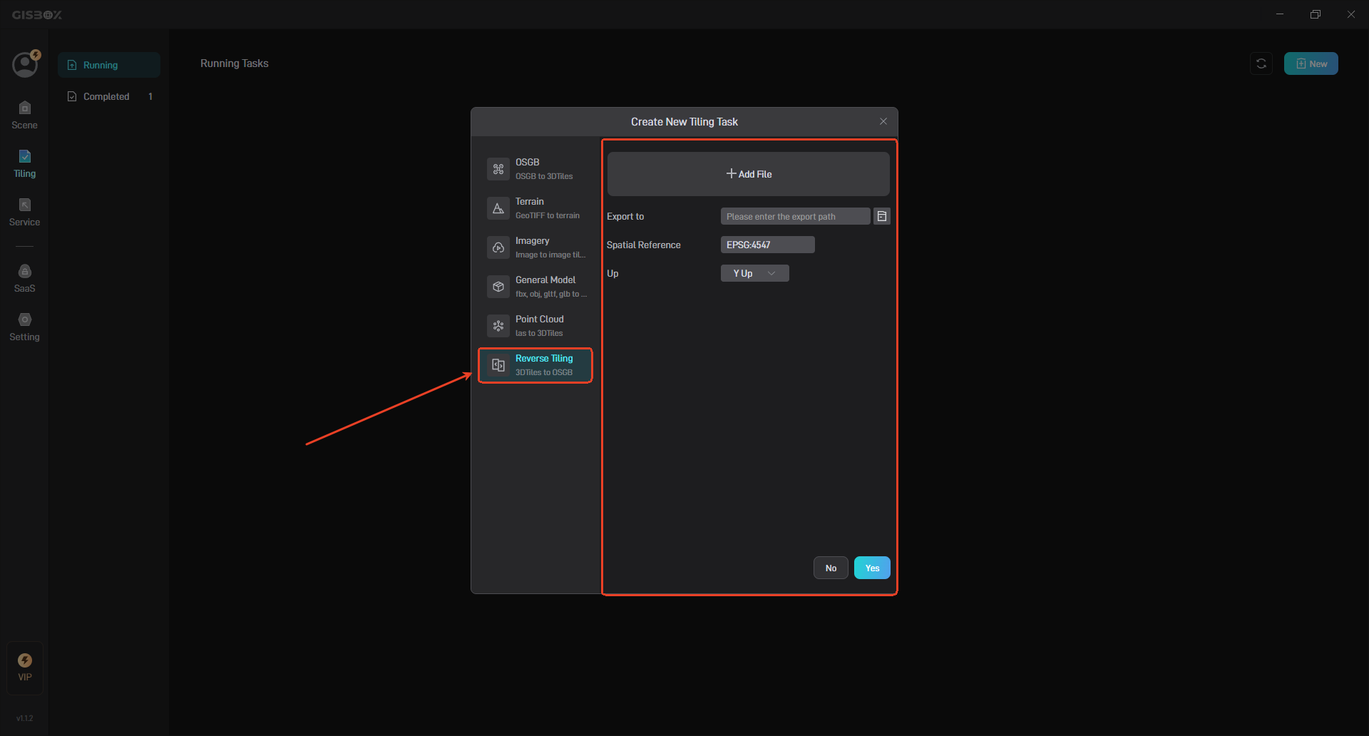
In GISBox, we provide a one-stop conversion method for various GIS file formats, including OSGB Tiling, Terrain Tiling, Imagery Tiling, General Model Tiling, Point Cloud Tiling and Reverse Tiling.
The following are pictures related to the tiling feature, OSGB Tiling feature:
Terrain Tiling feature:
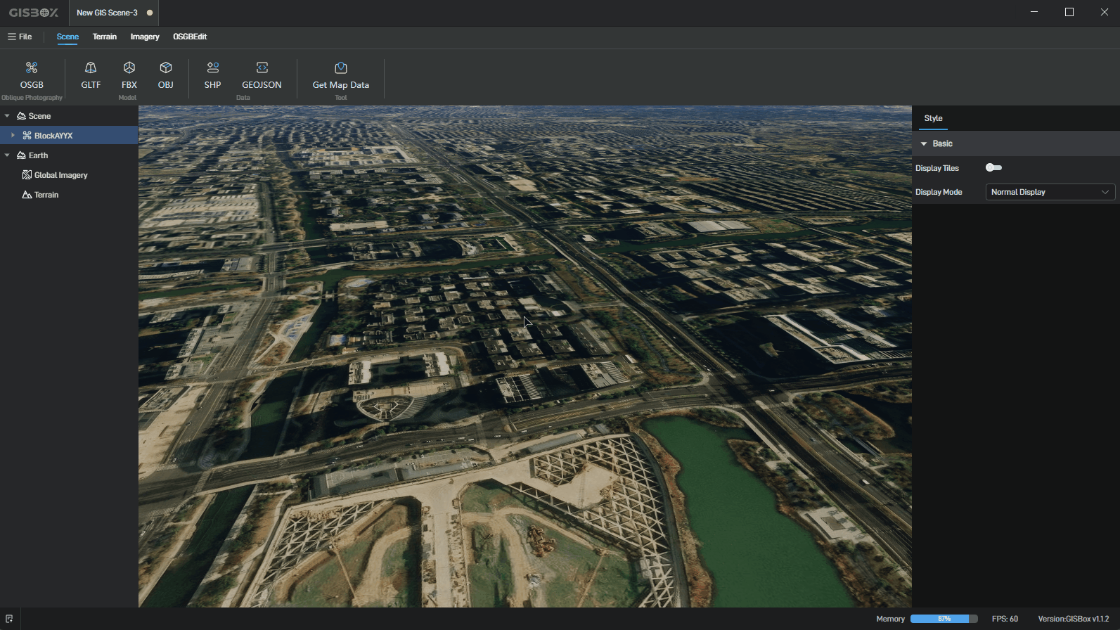
Imagery Tiling feature:

Point Cloud Tiling feature:
Reverse Tiling feature:
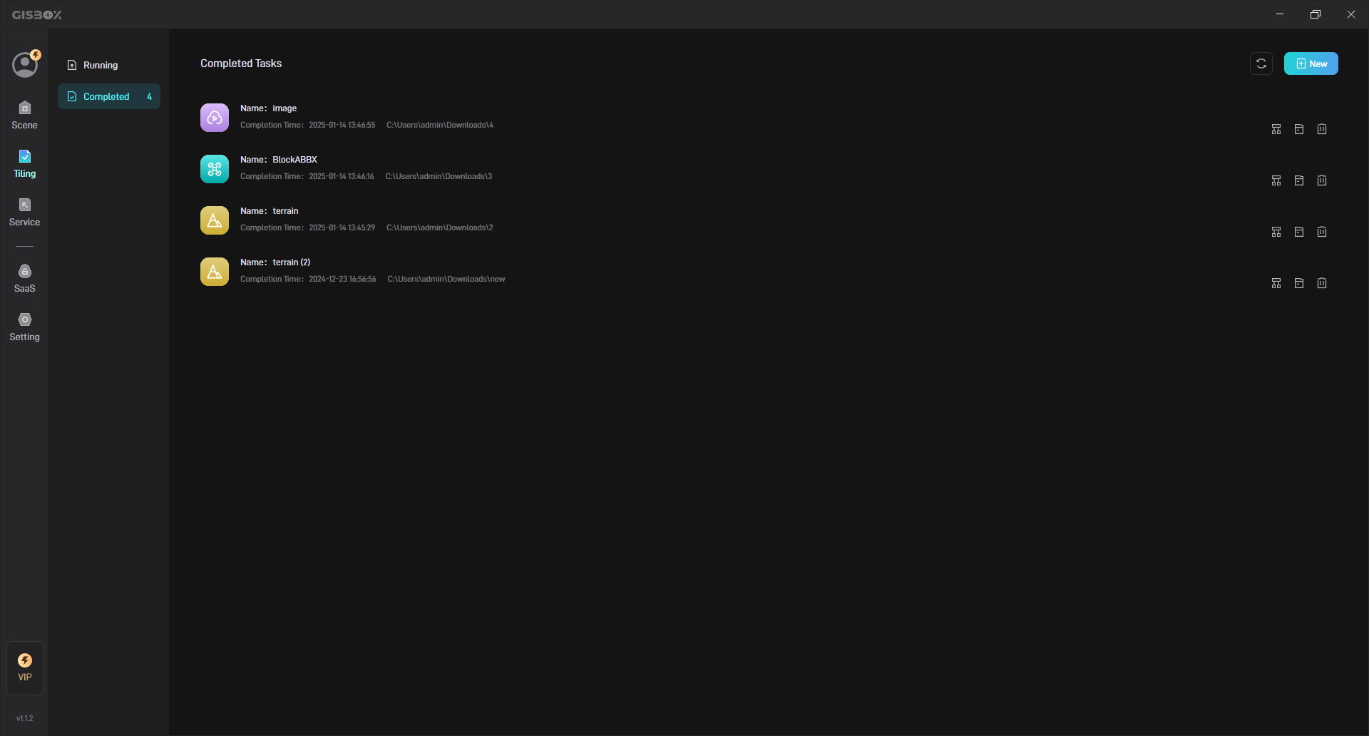
View the completed tiling tasks:
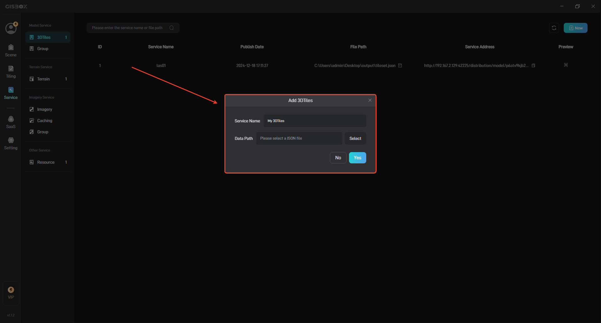
1.2 Distribution
After completing the tiling process, GISBox supports publishing the tiled data as a service for free, which is also known as its distribution feature. These services can be Imagery Service (such as** WMS, WMTS**), Terrain Service (such as WMTS-Terrain) or 3D Model Services (such as 3D Tiles). The generated service address can be applied to GIS engines such as Cesium or Cesium for Unreal, and can also be applied to digital twin project building platforms, such as Wings Engine.
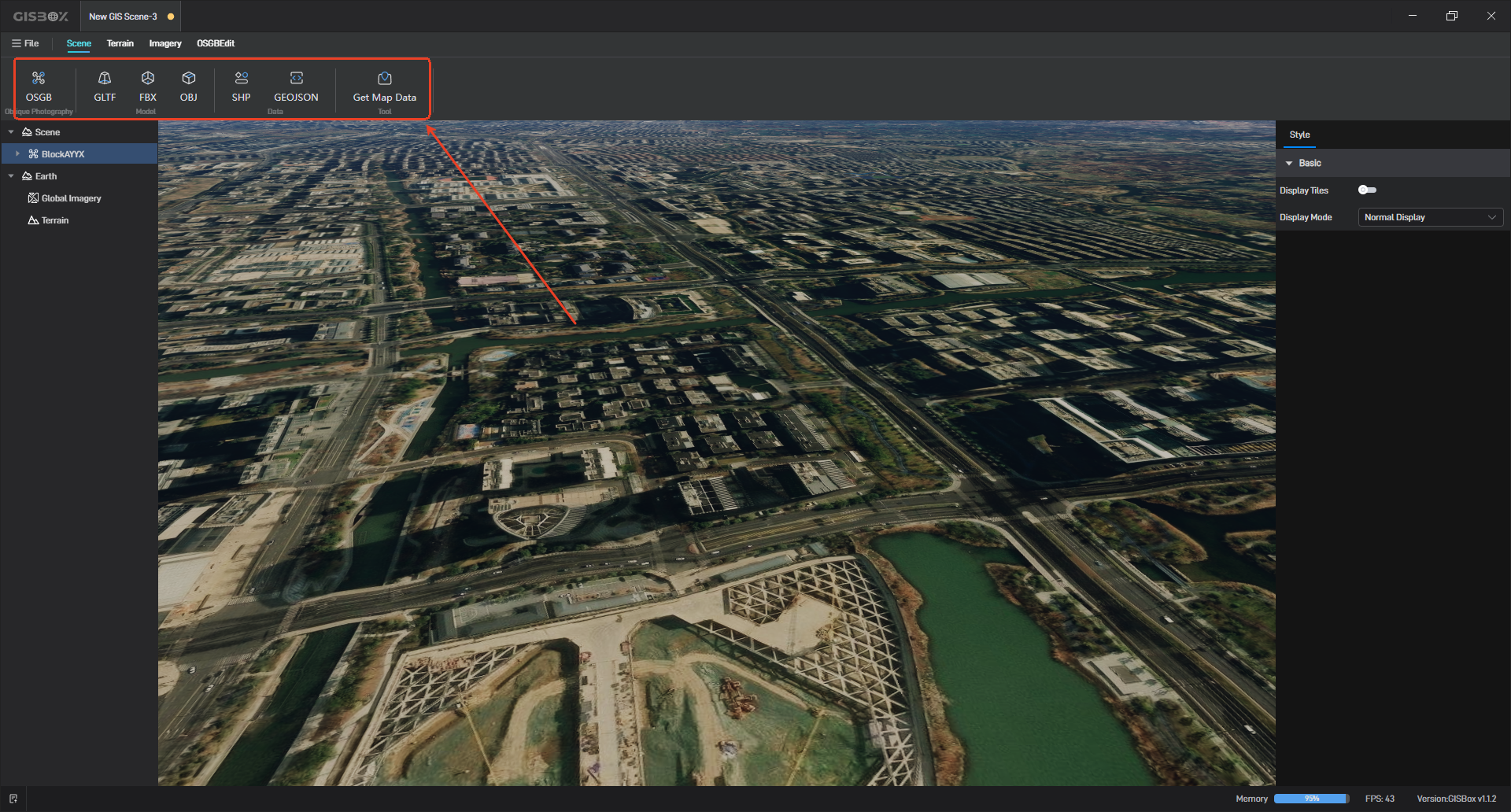
1.3 OSGB real-time preview and editing
GISBox supports importing OSGB, terrain, and imagery files into the “Scene” section for preview, and also allows for free editing of OSGB models.
2. Which features of GISBox are charged?
2.1 Import shp from the map to generate buildings
You can select the shp data to be imported from the map with one click, and automatically generate city building models of various styles. This feature can be used by purchasing the professional version package. The specific price can be viewed in the model lightweighting.
2.2 Performance Optimization
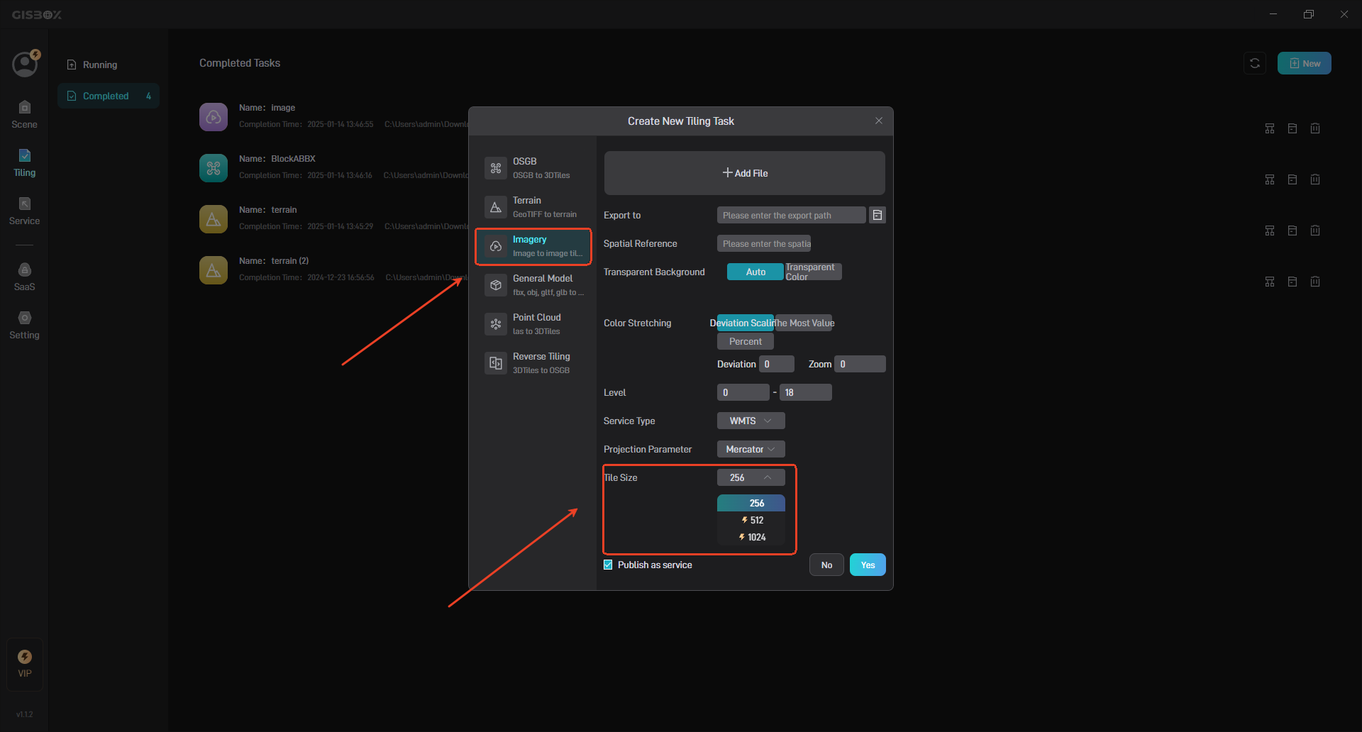
(1) Custom Tile Size
When GISBox tiles images, you can customize the tile size.
According to conventional tradition, the tile size is “256”, but in fact the tile size can be set to “non-256”, such as “512”, “1024”, the purpose of which is to reduce the number of tile requests on large screens. You can customize the tile size by purchasing the Professional Plan. The specific price can be viewed in Model Lightening.
(2) Model Lightening
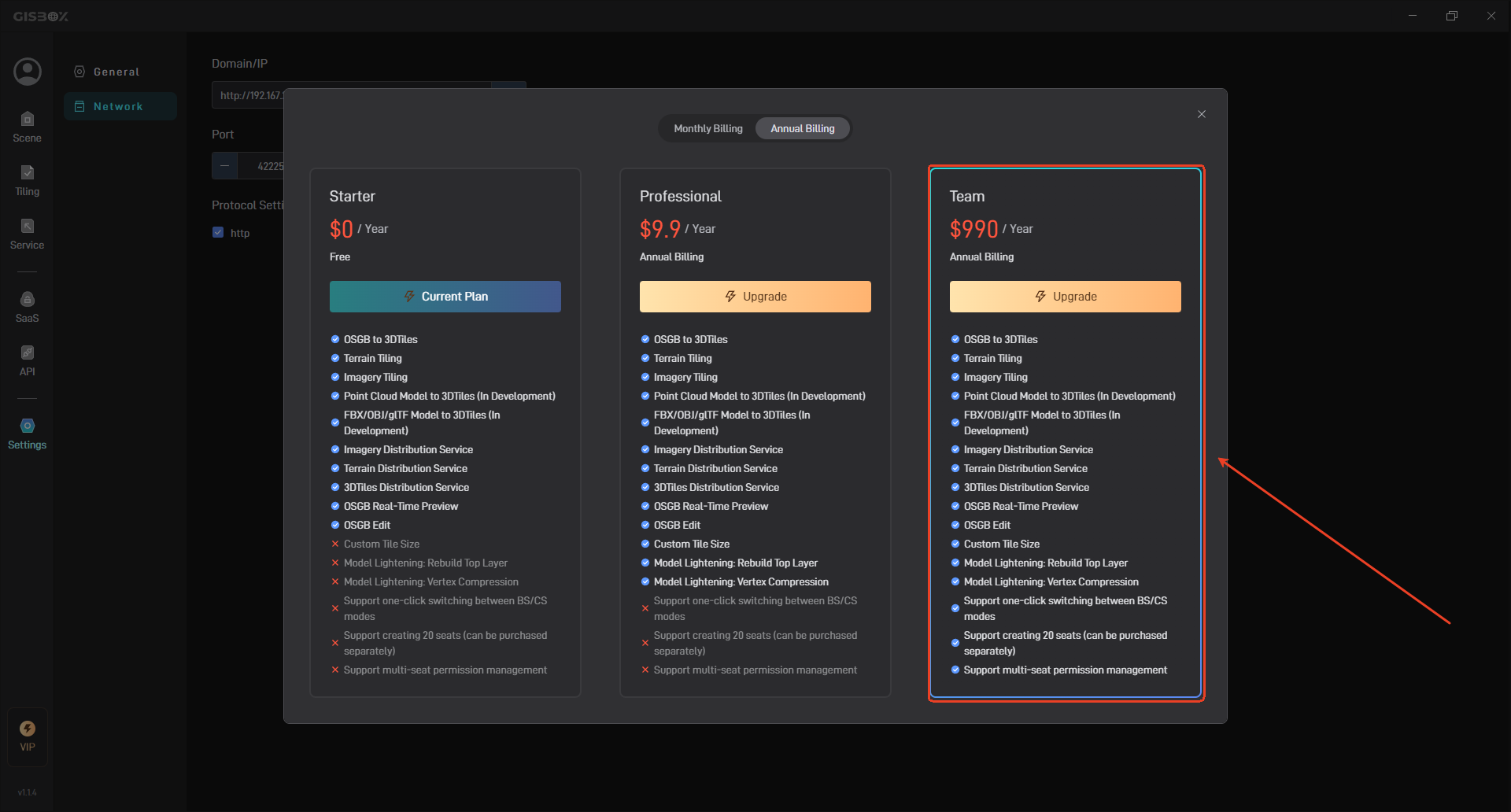
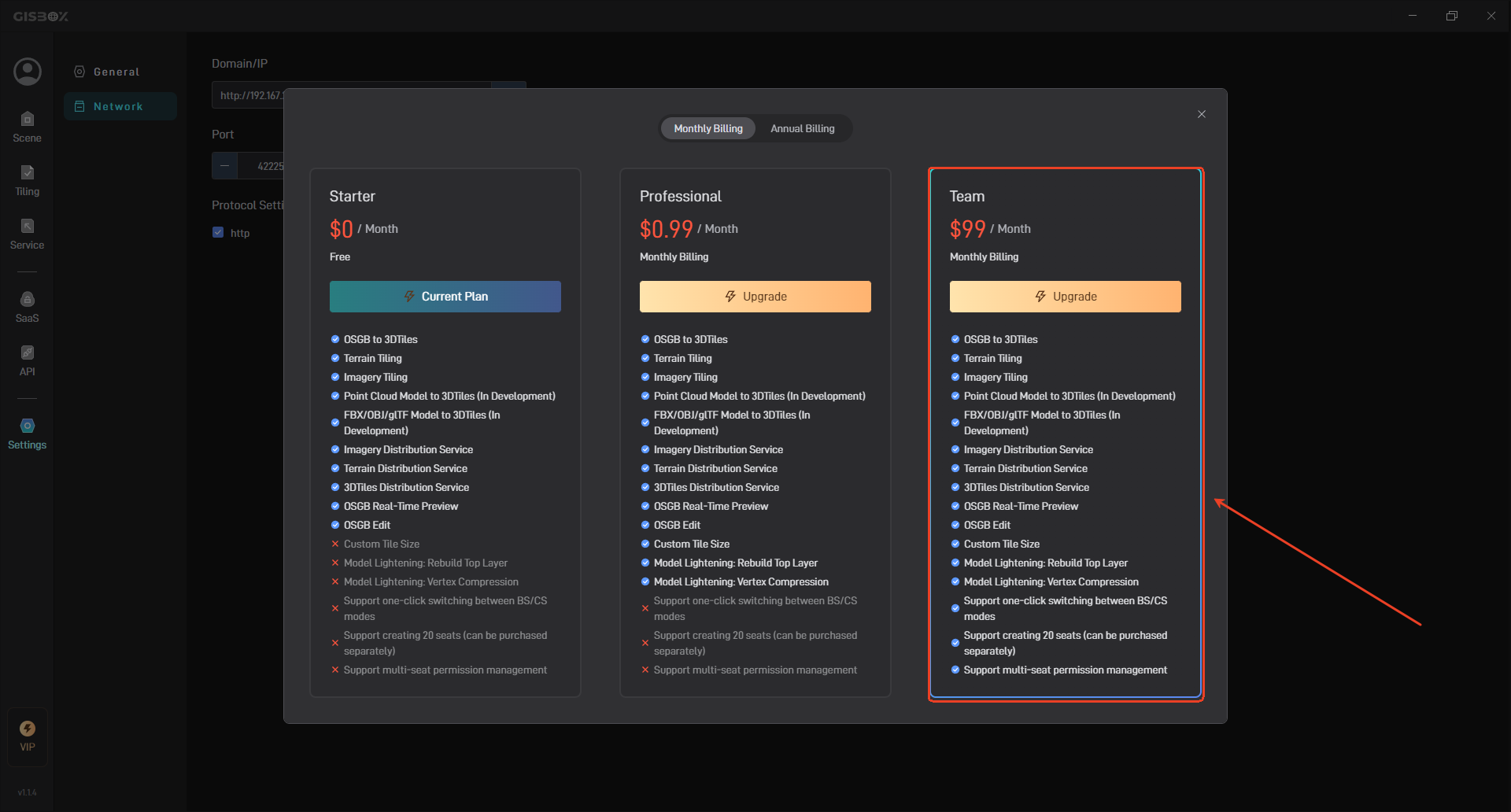
When the amount of tilted 3D model data is large, you can use the **model lightening **feature of GISBox and enable “Rebuild Top Layer”, “Vertex Compression”, and “KTX2 Texture Compression” to significantly improve loading performance and enhance the browsing experience. To use this feature, you need to purchase the Professional Plan, which is charged at $0.99/month, as shown in the figure below:
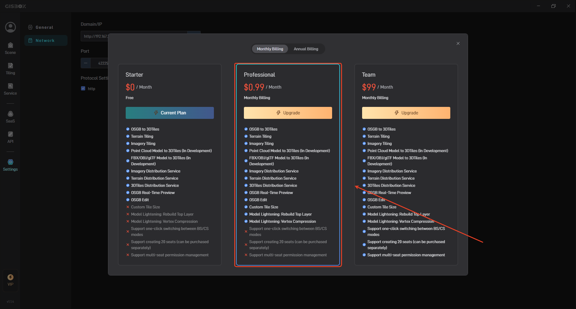
The annual fee is $99/year, as shown below:

2.3 Saas Service
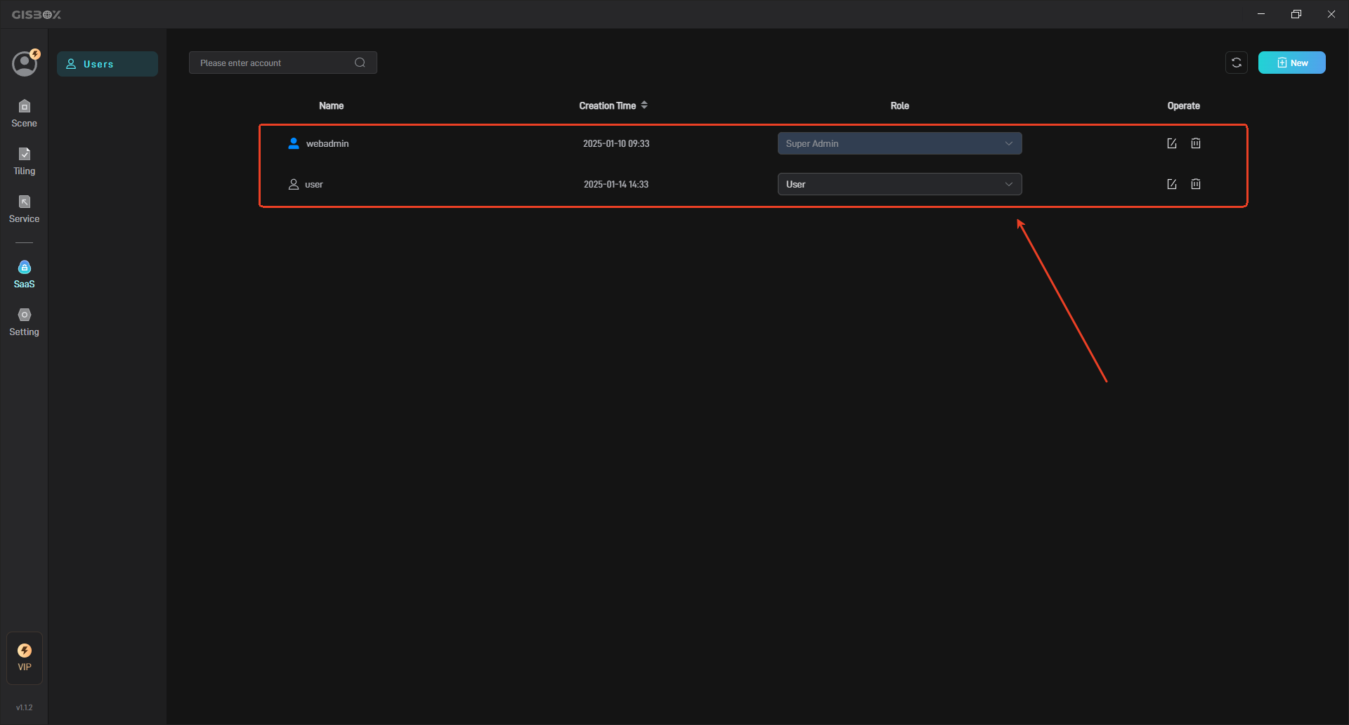
GISBox supports one-click switching between BS and CS modes without complex configuration. It supports multiple seats (20 seats, available for purchase) to collaboratively edit the same project, improving project development efficiency. It supports the management of multi-seat permissions, making collaboration quick and easy, as shown in the following figure:
SaaS service requires the purchase of Team Plan, which is billed at $99/month, as shown in the following figure:
The annual fee is $990/year, as shown below: