Real-time Cached Imagery
GISBox supports importing online imagery service interface addresses and then generating real-time cached imagery services.
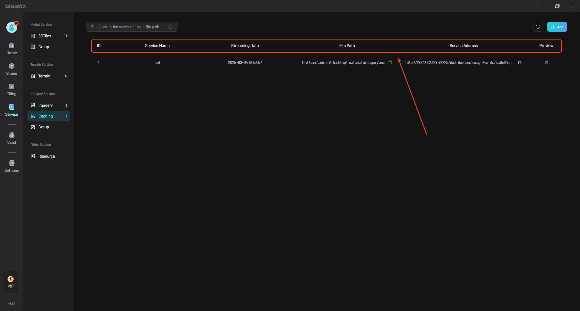
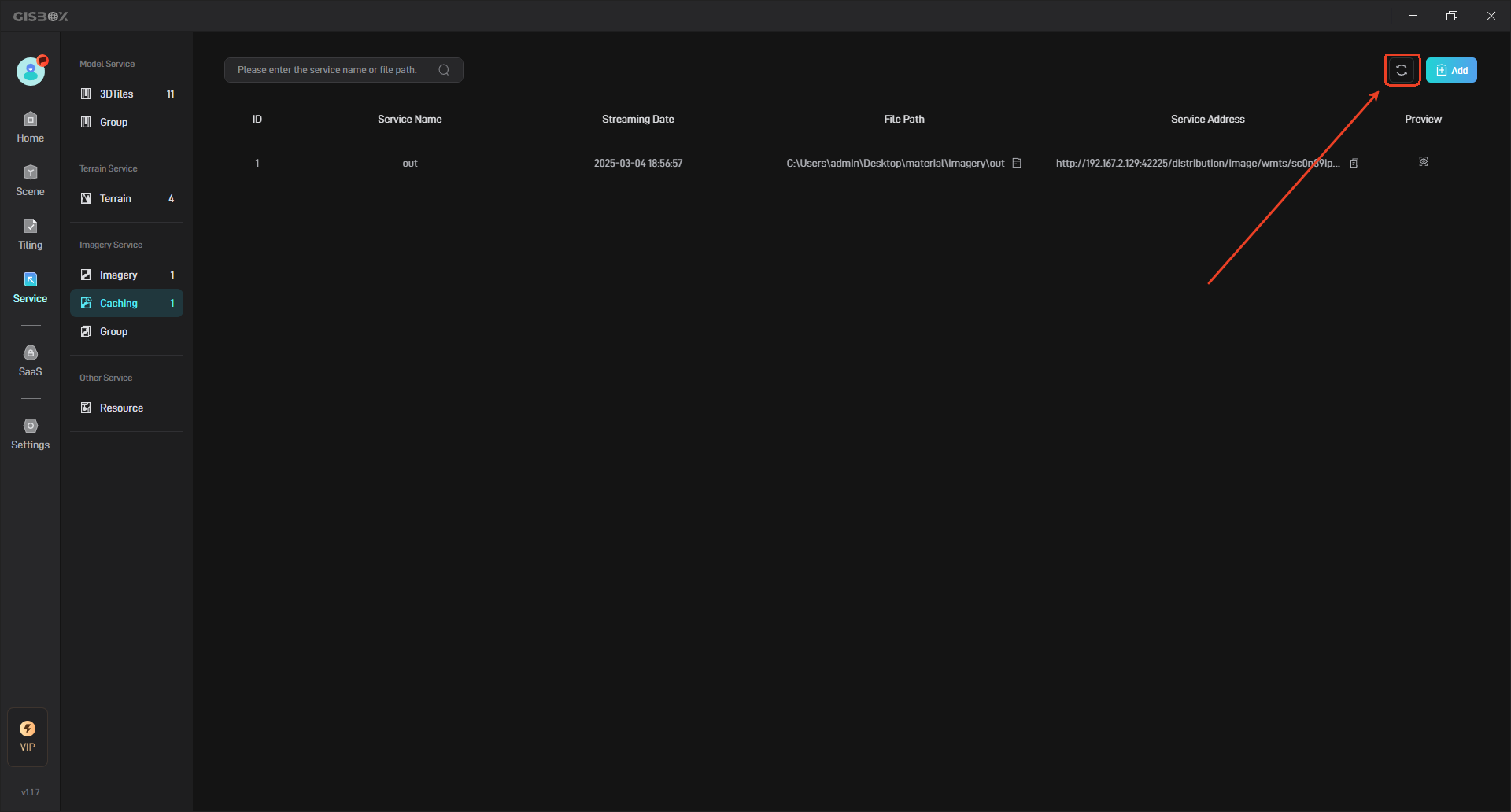
The generated real-time cached image service can be viewed in the “Caching” in the “Service” interface, as shown in the following figure:
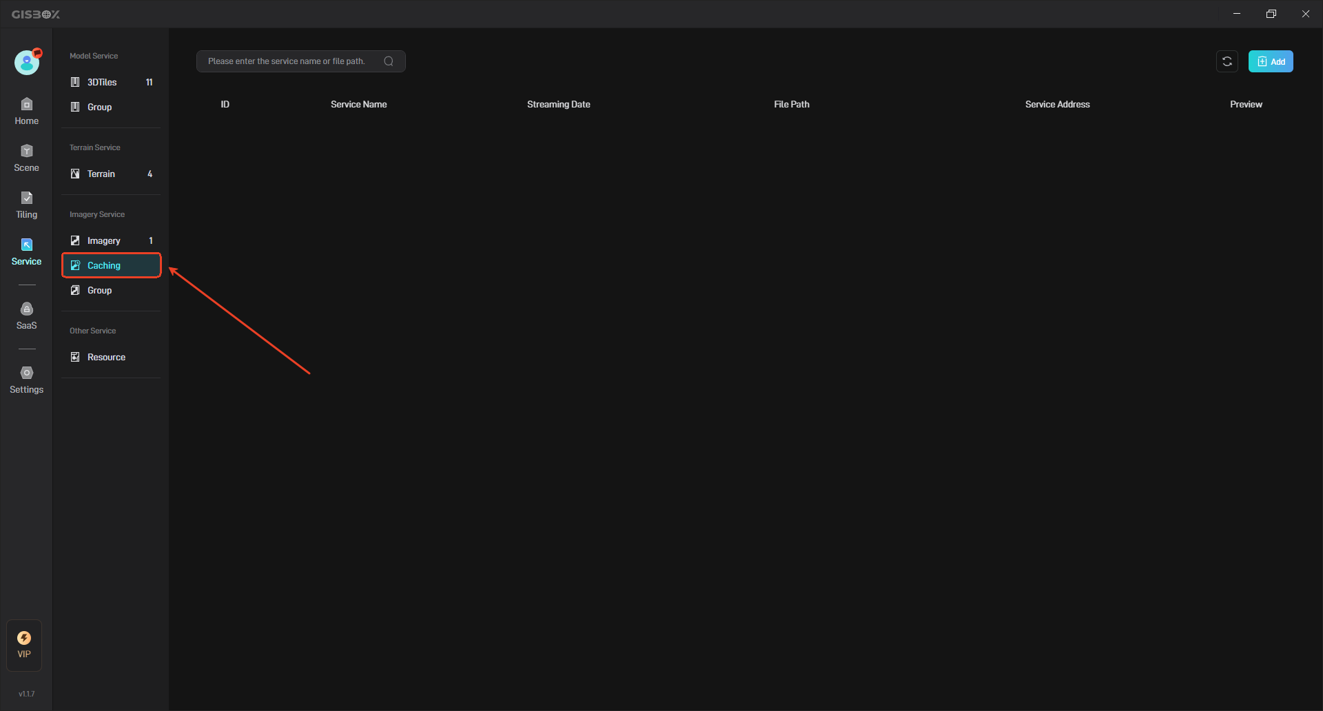
1. Add Caching Service
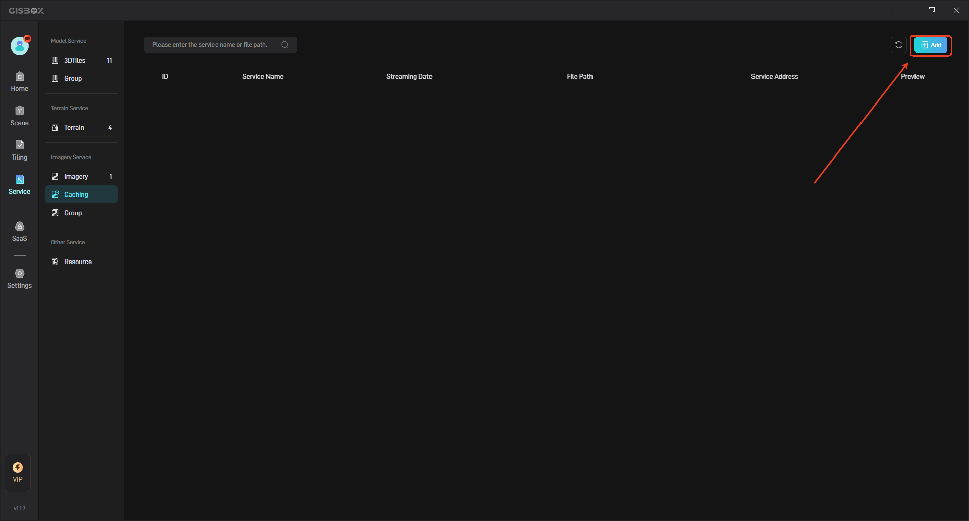
In the “Caching” interface, click the “Add” button in the upper right corner, as shown below:
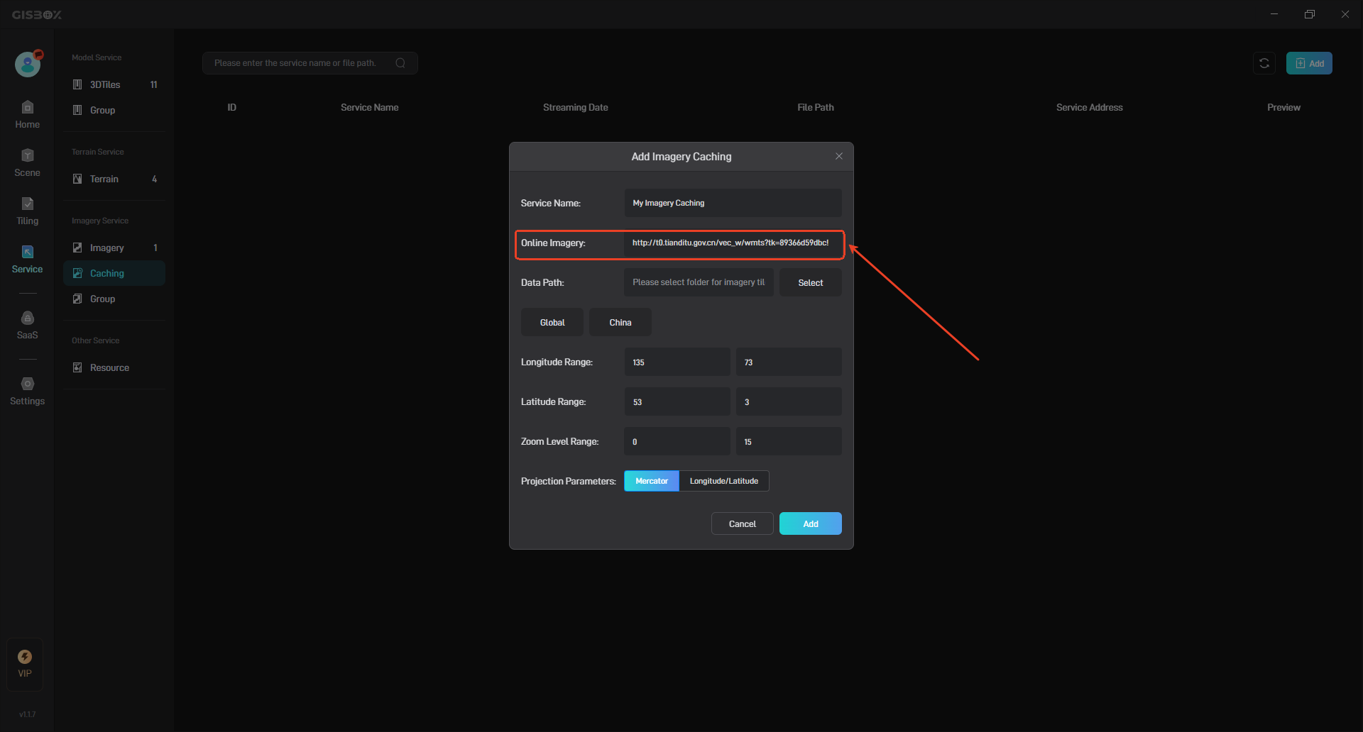
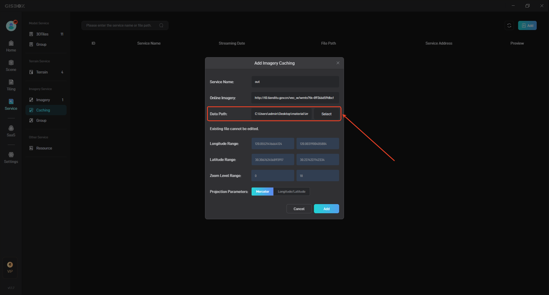
At this time, the “Add Imagery Caching” pop-up window will appear, and we can set the relevant configuration items, as shown in the following figure:
| Configuration item | Description |
|---|---|
| Service Name | Customize the service name of the input real-time cached imagery. |
| Online Imagery | Enter the online imagery service interface address here. |
| Data Path | Represents the local file path where the real-time cached imagery service is saved. You can select any empty local folder. |
| Longitude Range | Customize the longitude range. The default values are “180” and “-180”. |
| Latitude Range | Customize the latitude range. The default values are “90” and “-90”. |
| Zoom Level Range | The range of custom setting levels. Different levels will affect the distribution speed. The default value is “0-15”. |
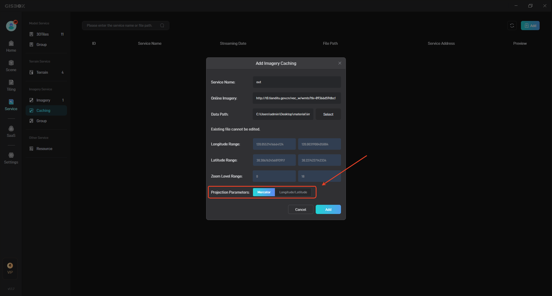
| Projection Parameters | Select the projection parameters, there are two options: “Mercator Projection” and “Latitude and Longitude Projection”. |
Enter the online image service interface address in the online imagery.
Select the folder for the imagery tile cache in the data path, as shown in the following figure:
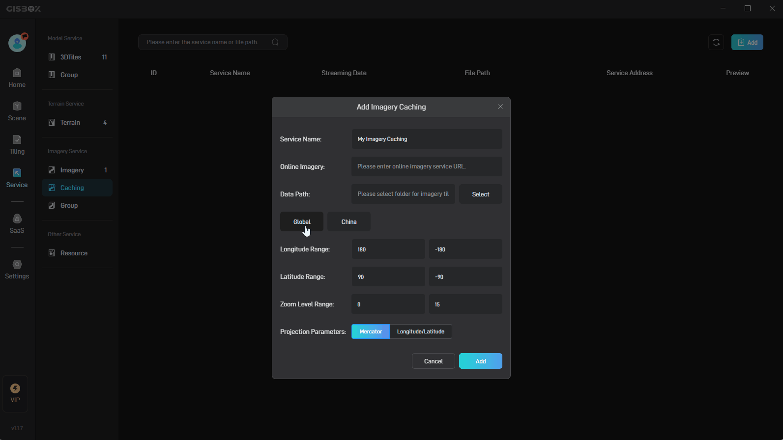
You can select the range of the imagery. After selecting “Global” or “China”, the latitude and longitude range will be automatically synchronized. The default is the global range, as shown in the figure below:
Select the corresponding projection parameters according to the type of the input online imagery service interface address, which are “Mercator Projection” and “Latitude and Longitude Projection”.
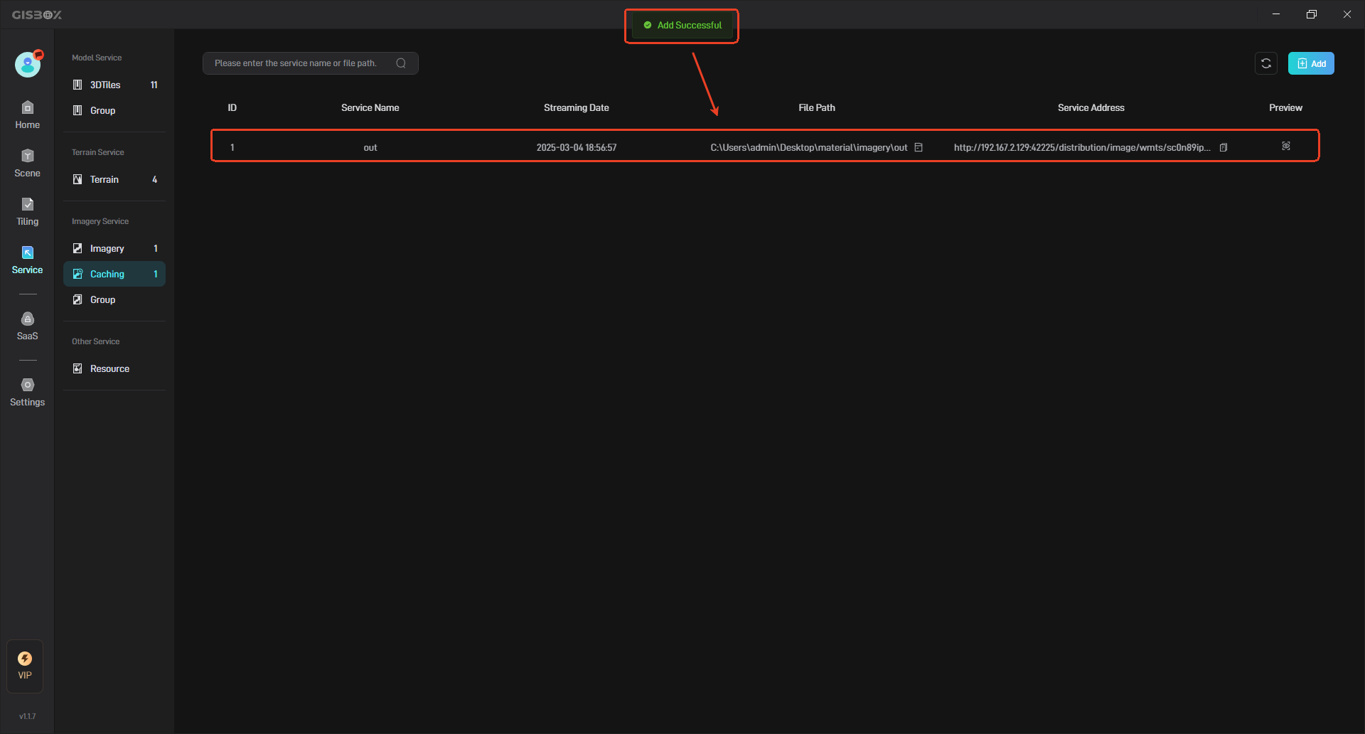
Then click the “Add” button, and the corresponding real-time cache image service will be generated in the real-time cached imagery.
2. Manage Real-time Cached Imagery Services
2.1 Configuration Item Description
| Configuration item | Description |
|---|---|
| ID | Each added real-time cached imagery service will have its own number and will be sorted in the order of release time. The earlier the release time, the larger the number. |
| Service Name | You can customize the service name. The default service name is the name of the file imported when the real-time cached imagery is sliced. |
| Release time | Indicates the time when the real-time cached imagery service is released. |
| File Path | Indicates the file path where the real-time cached imagery service is saved locally. |
| Service Address | The service address generated by GISBox can be applied to GIS platforms such as Cesium, and can also be applied to some digital twin project building platforms, such as Wings Engine. |
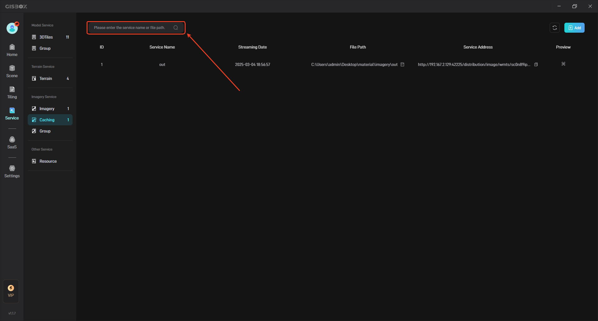
2.2 Search Caching Service
You can enter the service name or file path in the search bar to search.
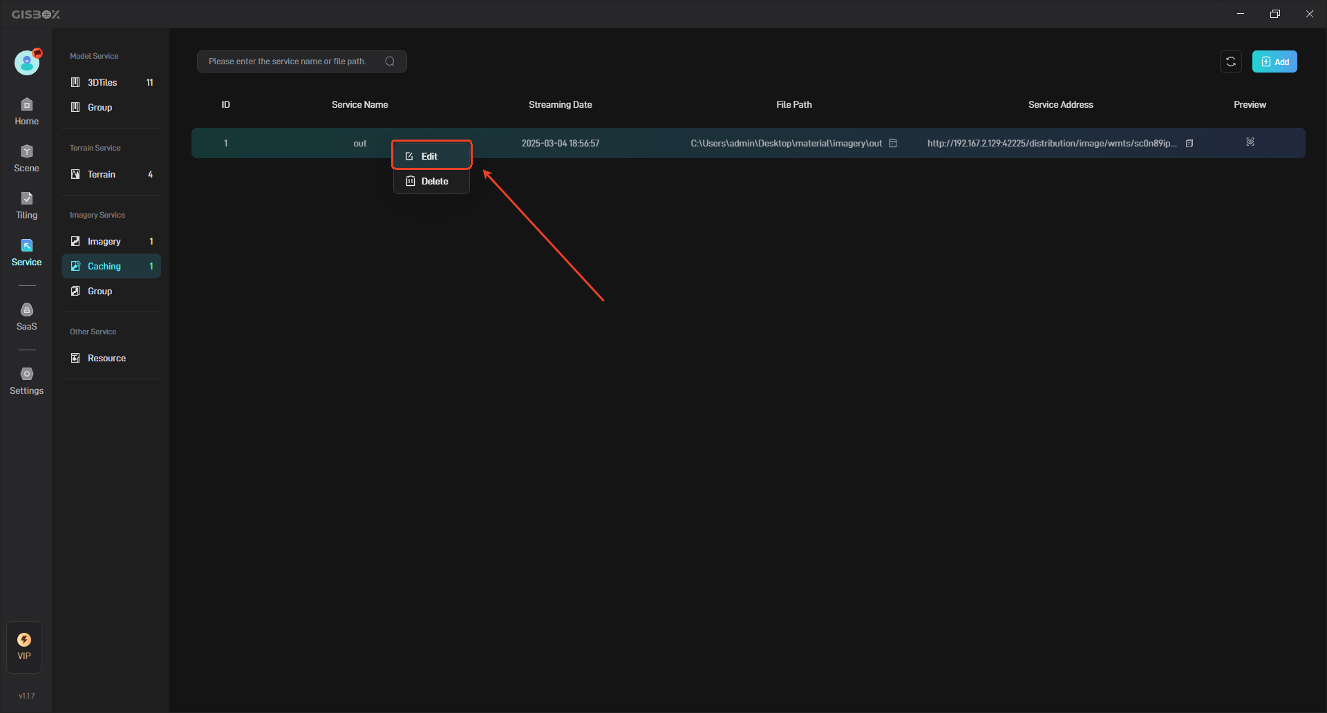
2.3 Rename Real-time Cached Imagery Service
Move the mouse to the real-time cached imagery service that needs to be renamed, right click, and then click “Edit” to rename the real-time cached imagery service.
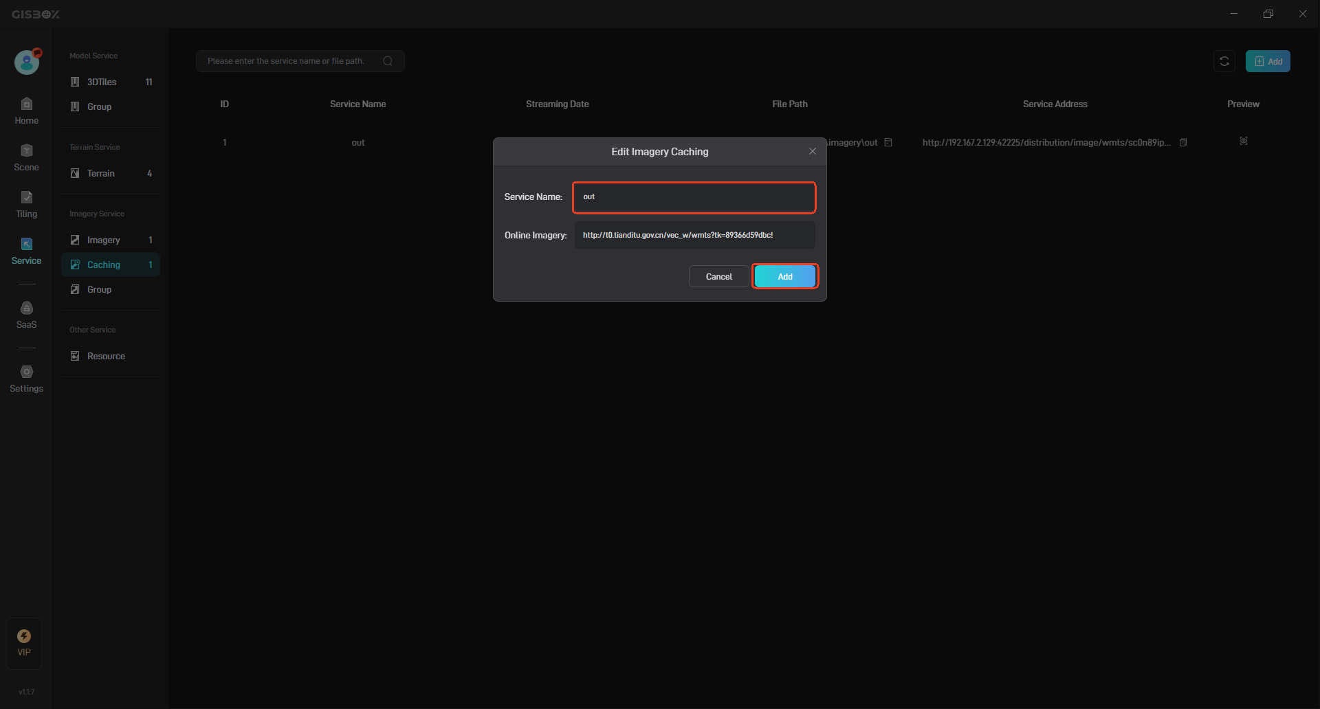
Enter a new name and click the “Add” button to complete the renaming, as shown below:
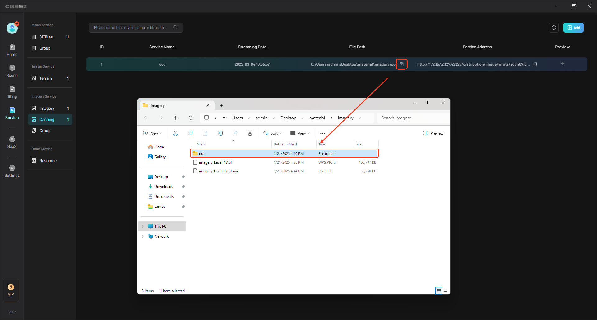
2.4 View File Path
Click the “Folder” button in the file path to view the local file path of the terrain service, as shown in the following figure:
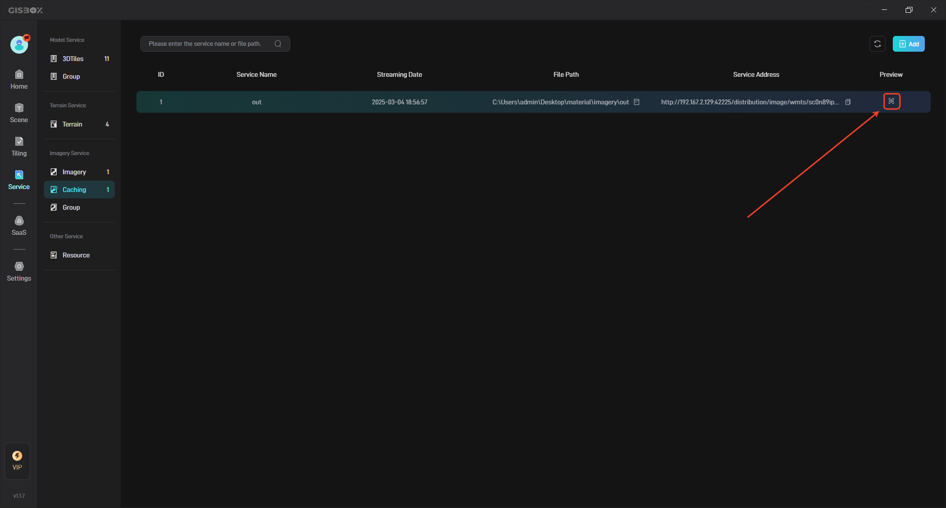
2.5 Preview Real-time Cached Imagery Service
Click the “Preview” button to preview the terrain service in the browser, as shown below:
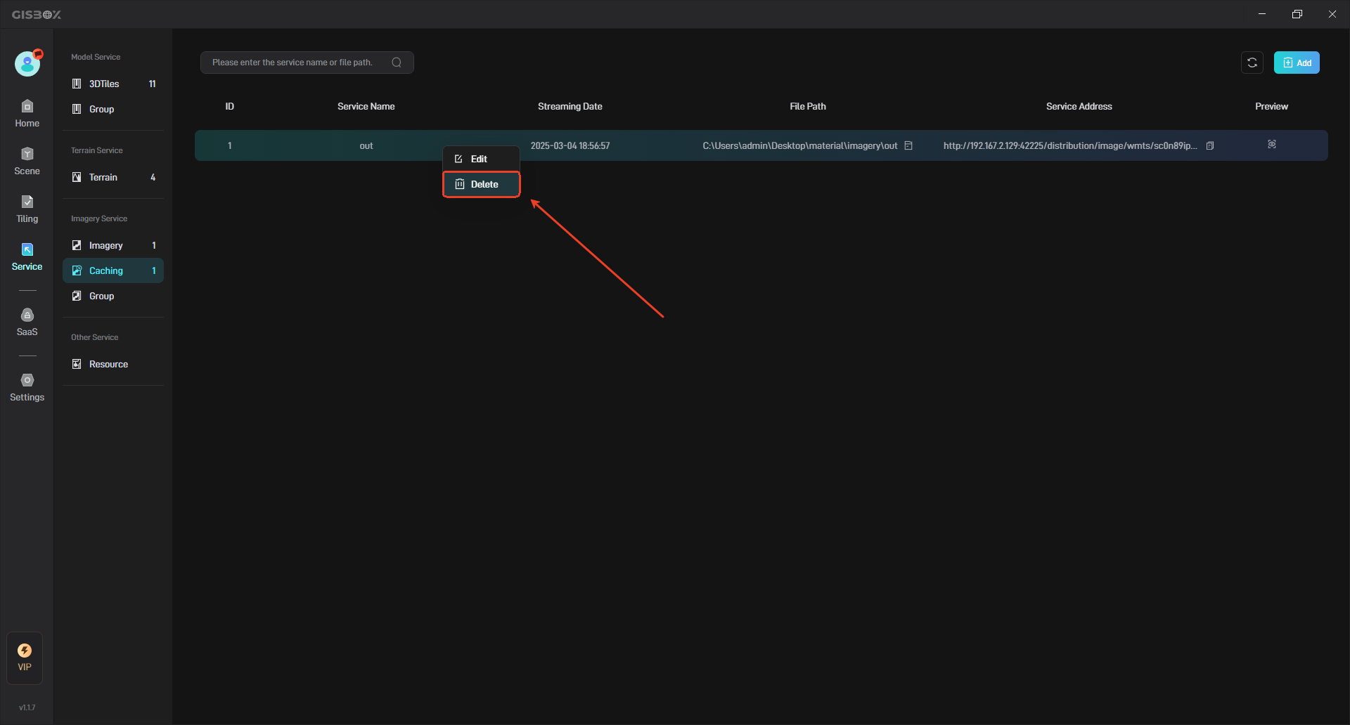
2.6 Delete Service
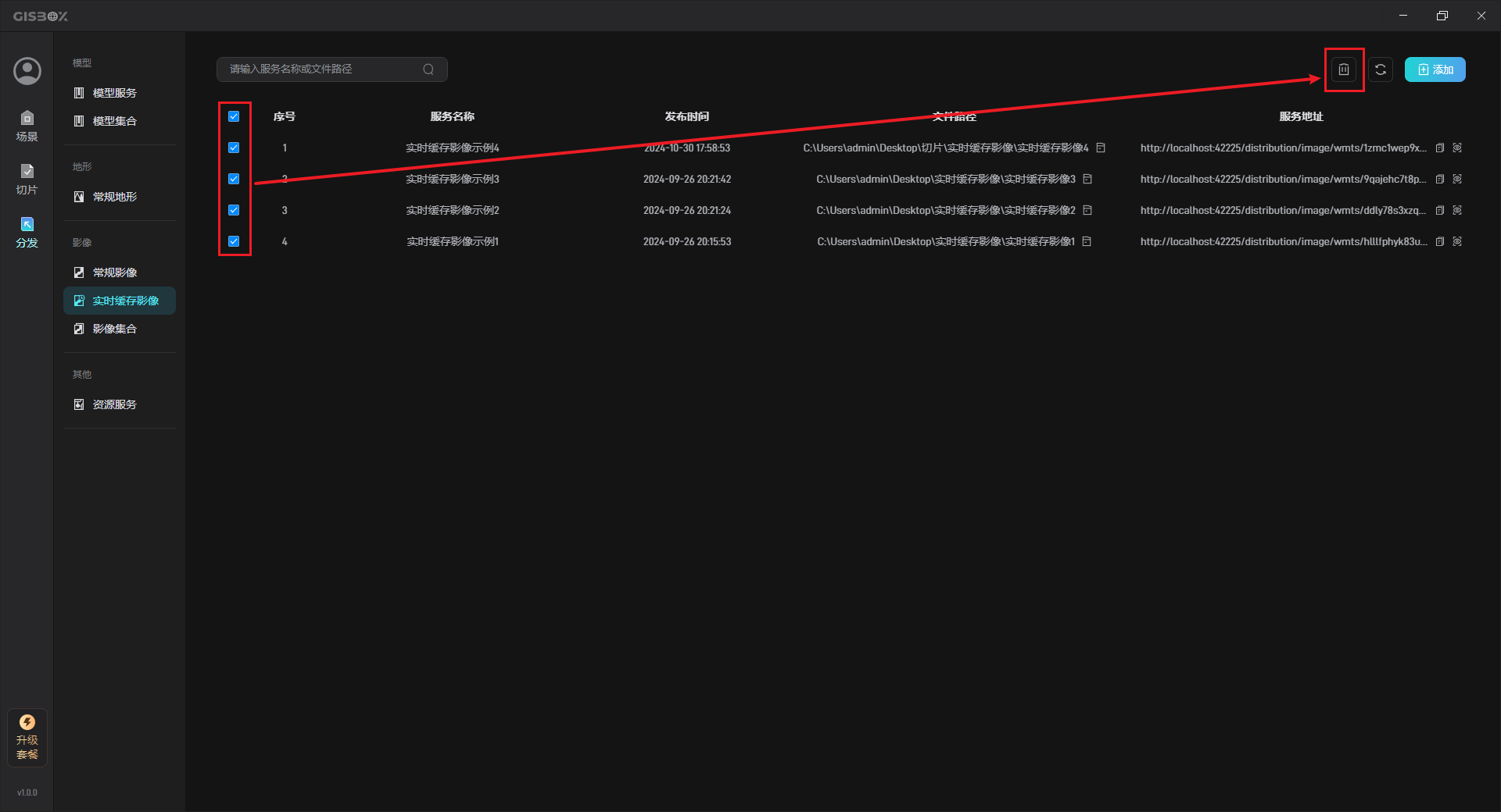
Select the cacheing service that needs to be deleted, and then click the “Delete” button to delete the selected caching service.
You can select multiple/all real-time cached imagery services, and then delete all selected real-time cached imagery services with one click.
2.7 Refresh Service
When a new caching service is added but is not displayed in the “Real-time Cached Imagery” interface, you can click the “Refresh” button in the upper right corner to load the newly added real-time cached imagery service, as shown in the following figure:
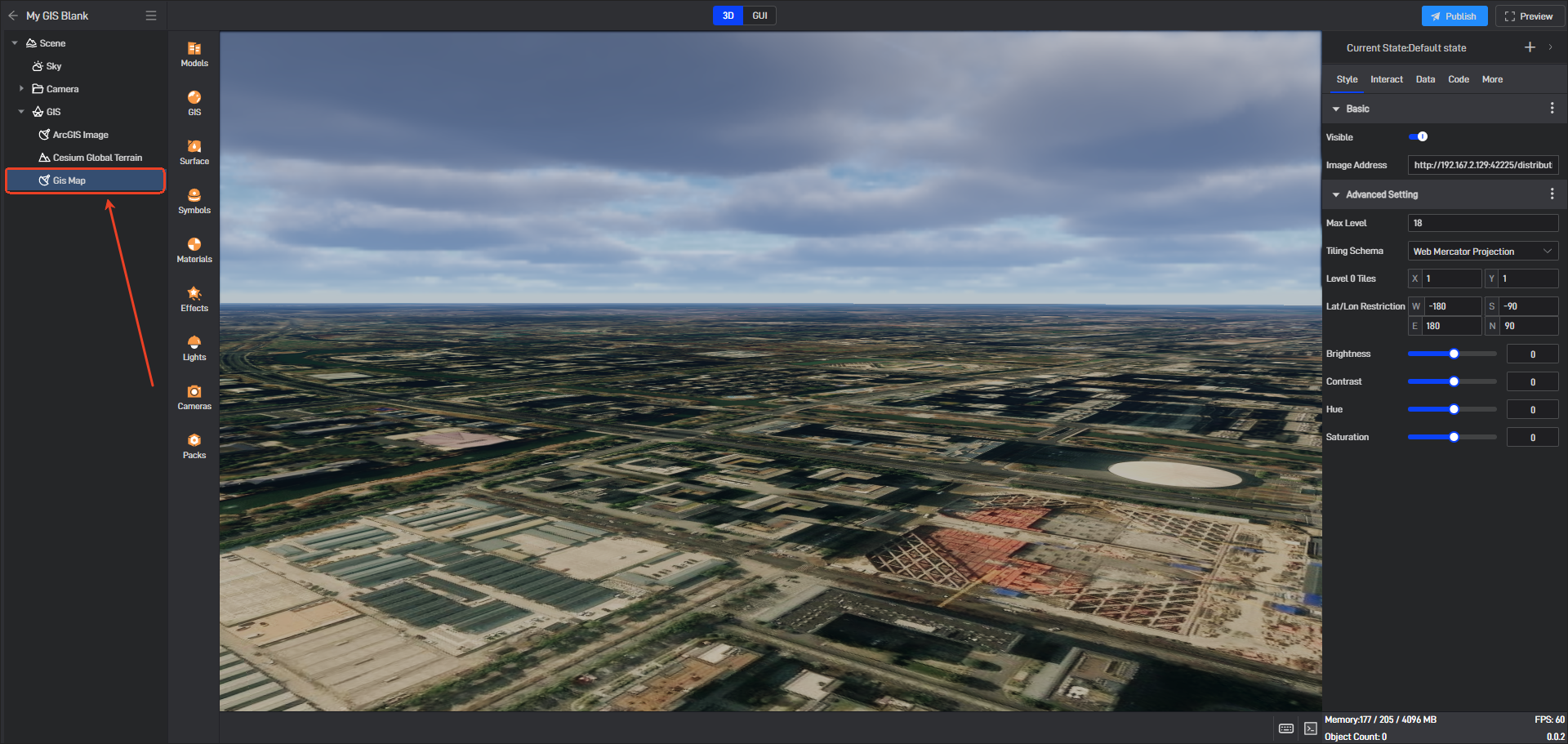
3. Use service address
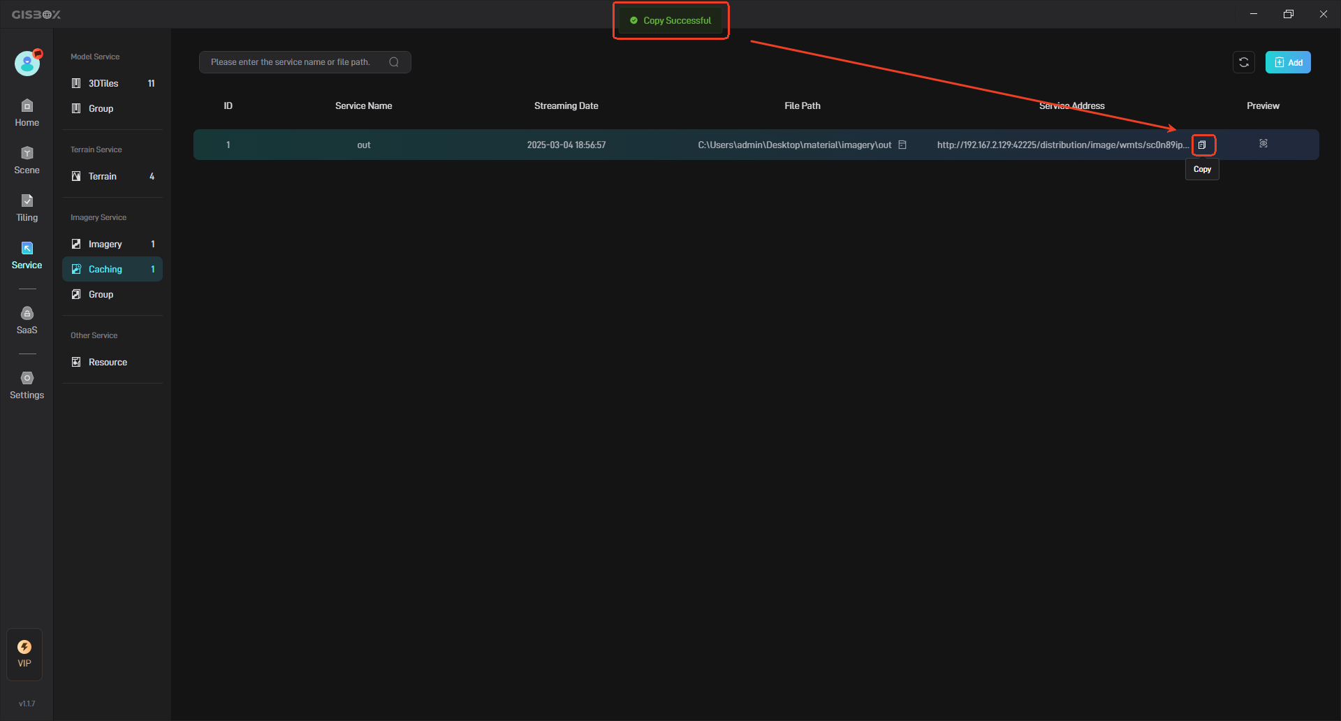
The generated service address can be applied to GIS platforms such as Cesium, and can also be applied to some digital twin project building platforms, such as Wings Engine. The following takes “Connecting the service address to Wings Engine” as an example to illustrate:
First, click the “Copy” button to copy the terrain service address, as shown below:
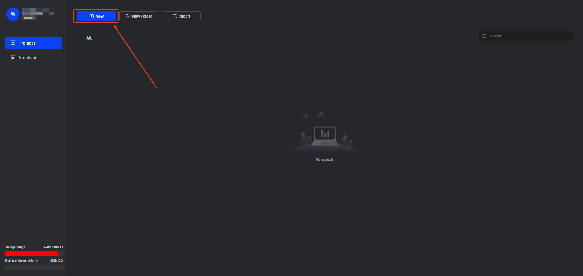
Open Wings Engine and click the “New” button in the upper left corner to create a new project.
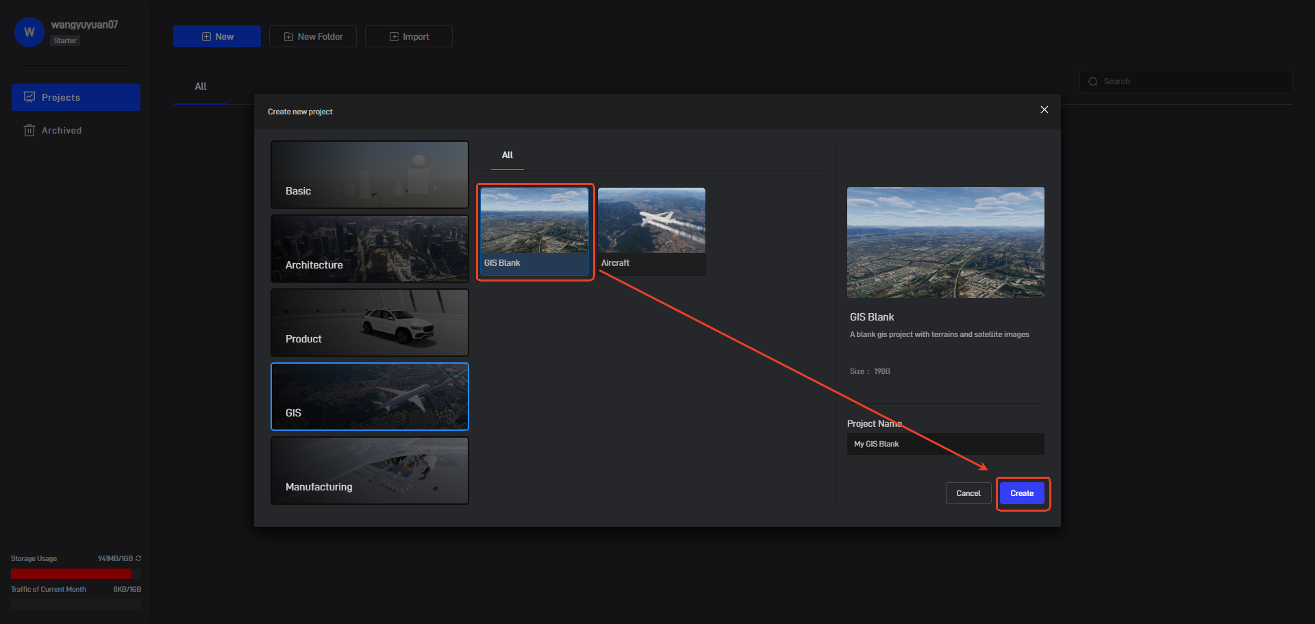
Click GIS on the left, select “GIS Blank”, enter the project name, and finally click the “Create” button.
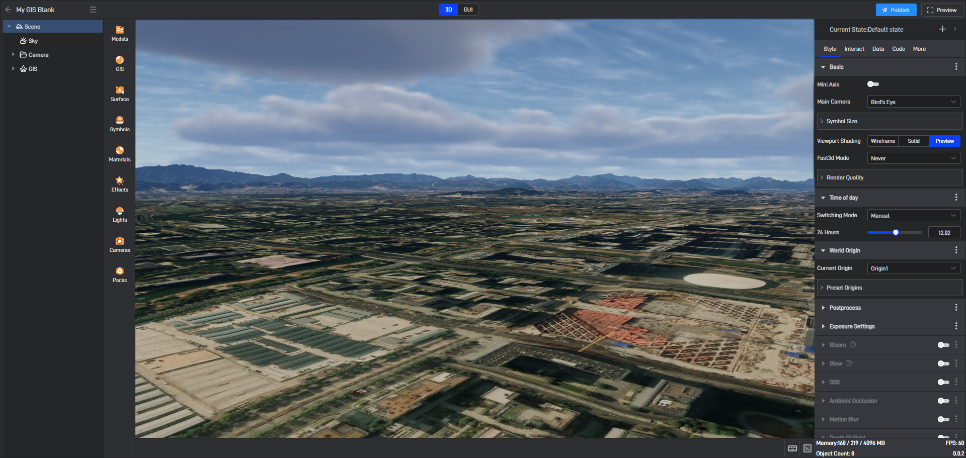
After the project is successfully created, it will be automatically opened, as shown below:
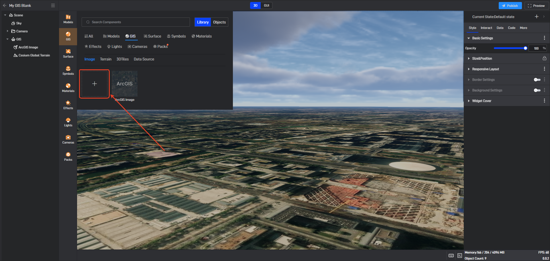
Click GIS Service on the left, select “Terrain”, and click “+” to open the pop-up window for importing terrain, as shown below:
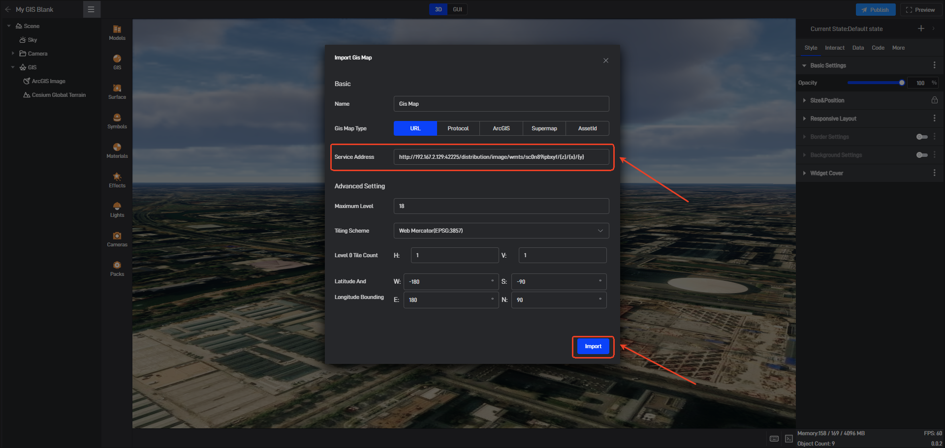
Select “Cesium Terrain” as the import type and “Service Address” as the import method. Then paste the copied service address into the input field and click the “Import” button.
You can see the imported terrain in the “GIS layer” of the component layer, as shown below: